| | 10 new stories for 2017/01/24
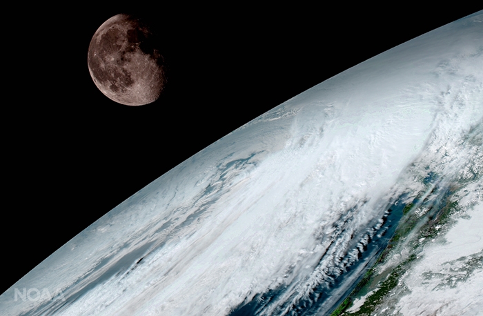
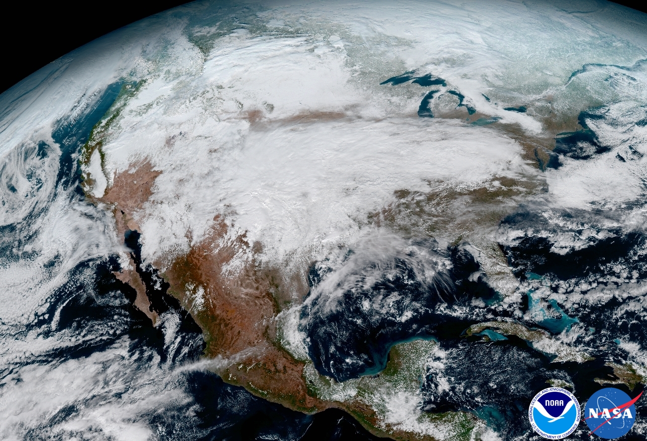
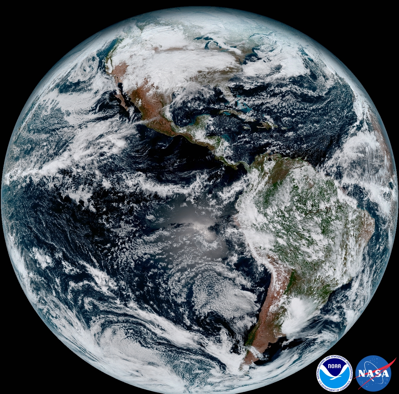
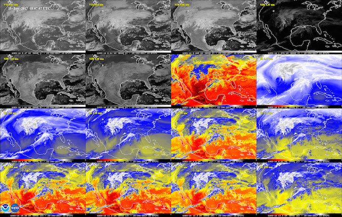
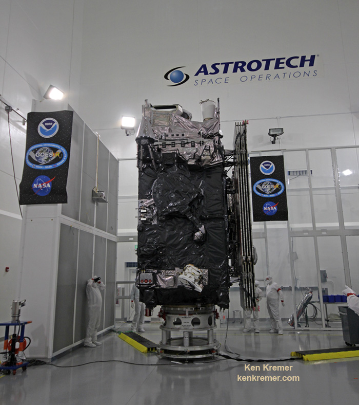
New Age in Weather Forecasting Begins with Spectacular 1st Images from NASA/NOAA GOES-16 Observatory  GOES-16 (previously known as GOES-R) captured this view of the moon as it looked across the surface of the Earth on January 15, 2017. Like earlier GOES satellites, GOES-16 will use the moon for calibration. Credit: NOAA/NASA KENNEDY SPACE CENTER, FL – A new age has begun in the nations weather forecasting capabilities with the release today (Jan. 23) of the spectacular first images gathered by the recently launched NASA/NOAA GOES-16 observatory. The highly advanced Geostationary Operational Environmental Satellite-16 (GOES-16) weather observatory lifted off two months ago atop a ULA Atlas V rocket on Nov. 19, 2016 from Space Launch Complex 41 (SLC-41) on Cape Canaveral Air Force Station, Florida. GOES-16 (formerly known as GOES-R through the launch) is the first in a new series of revolutionary NASA/NOAA geostationary weather satellites that entails the first significant instrument upgrade to US weather forecasting capabilities in more than two decades. "It will be like high-definition from the heavens," says NOAA. "Today’s release of the first images from #GOES16 signals the start of a new age in satellite weather observation!!!" Thus the newly obtained and published imagery has been anxiously awaited by scientists, meteorologists and ordinary weather enthusiasts. "This is such an exciting day for NOAA! One of our GOES-16 scientists compared this to seeing a newborn baby's first pictures — it's that exciting for us," said Stephen Volz Ph.D. director of NOAA's Satellite and Information Service, in a statement. "These images come from the most sophisticated technology ever flown in space to predict severe weather on Earth. The fantastically rich images provide us with our first glimpse of the impact GOES-16 will have on developing life-saving forecasts."  This image clearly shows the significant storm system that crossed North America that caused freezing and ice that resulted in dangerous conditions across the United States on January 15, 2017 resulting in loss of life. Credit: NOAA/NASA An especially eye-popping image taken by GOES -16 from its equatorial vantage point situated in geostationary orbit 22,300 miles above Earth and published today, shows both the Earth and the Moon together – as the lead image here. The Earth/Moon combo shot is not only fantastically pleasing to the eye, but also serves a significant scientific purpose. “Like earlier GOES satellites, GOES-16 will use the moon for calibration," say NOAA officials. "GOES-16 will boost the nation's weather observation network and NOAA's prediction capabilities, leading to more accurate and timely forecasts, watches and warnings." GOES-16 is the most advanced and powerful weather observatory ever built and will bring about a 'quantum leap' in weather forecasting. It's dramatic new imagery will show the weather in real time enabling critical life and property forecasting, help pinpoint evacuation zones and also save people's lives in impacted areas of severe weather including hurricanes and tornadoes. And the huge satellite can't come online soon enough, as demonstrated by the severe winter weather and tornadoes that just wreaked havoc and death in various regions of the US. Another breathtaking image product (seen below) produced by the GOES-16 Advanced Baseline Imager (ABI) instrument, built by Harris Corporation, shows a full-disc view of the Western Hemisphere in high detail — at four times the image resolution of existing GOES spacecraft.  This composite color full-disk visible image shows North and South America and was taken on January 15, 2017. It was created using several of the 16 spectral channels available on the GOES-16 Advanced Baseline Imager (ABI) instrument. Credit: NOAA/NASA The 11,000 pound satellite was built by prime contractor Lockheed Martin and is the first of a quartet of four identical satellites – comprising GOES-R, S, T, and U – at an overall cost of about $11 Billion. This will keep the GOES satellite system operational through 2036. This next generation of GOES satellites will replace the currently operating GOES East and GOES West satellites. NOAA will soon decide whether GOES-16 will replace either the East or West satellites. A decision from NOAA is expected in May. Of course everyone wants it first. The next satellite is nearing assembly completion and will undergo about a year of rigorous environmental and acoustic testing before launch.  This 16-panel image shows the continental United States in the two visible, four near-infrared and 10 infrared channels on the Advanced Baseline Imager (ABI). These channels help forecasters distinguish between differences in the atmosphere like clouds, water vapor, smoke, ice and volcanic ash. Credit: NOAA/NASA The six instrument science suite includes the Advanced Baseline Imager (ABI) built by Harris Corporation, the Geostationary Lightning Mapper (GLM) built by Lockheed Martin, Solar Ultraviolet Imager (SUVI), Extreme Ultraviolet and X-Ray Irradiance Sensors (EXIS), Space Environment In-Situ Suite (SEISS), and the Magnetometer (MAG). ABI is the primary instrument and will collect 3 times more spectral data with 4 times greater resolution and scans 5 times faster than ever before – via the primary Advanced Baseline Imager (ABI) instrument – compared to the current GOES satellites. "The higher resolution will allow forecasters to pinpoint the location of severe weather with greater accuracy. GOES-16 can provide a full image of Earth every 15 minutes and one of the continental U.S. every five minutes, and scans the Earth at five times the speed of NOAA's current GOES imagers."  The NASA/NOAA GOES-R (Geostationary Operational Environmental Satellite – R Series) being processed at Astrotech Space Operations, in Titusville, FL, in advance of successful launch on a ULA Atlas V on Nov. 19, 2016. GOES-R/GOES-16 will be America's most advanced weather satellite. Credit: Ken Kremer/kenkremer.com
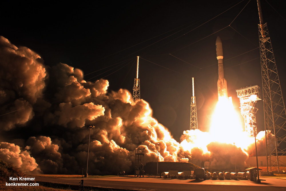
GOES-R launched on the massively powerful Atlas V 541 configuration vehicle, augmented by four solid rocket boosters on the first stage.  Blastoff of revolutionary NASA/NOAA GOES-R (Geostationary Operational Environmental Satellite – R Series) on ULA Atlas V from Space Launch Complex 41 (SLC-41) on Cape Canaveral Air Force Station, Florida on Nov. 19, 2016. GOES-R will deliver a quantum leap in America's weather forecasting capabilities. Credit: Ken Kremer/kenkremer.com
Stay tuned here for Ken’s continuing Earth and Planetary science and human spaceflight news. Ken Kremer The post New Age in Weather Forecasting Begins with Spectacular 1st Images from NASA/NOAA GOES-16 Observatory appeared first on Universe Today.
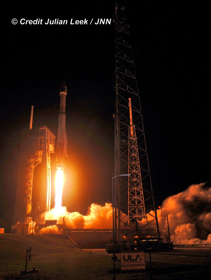
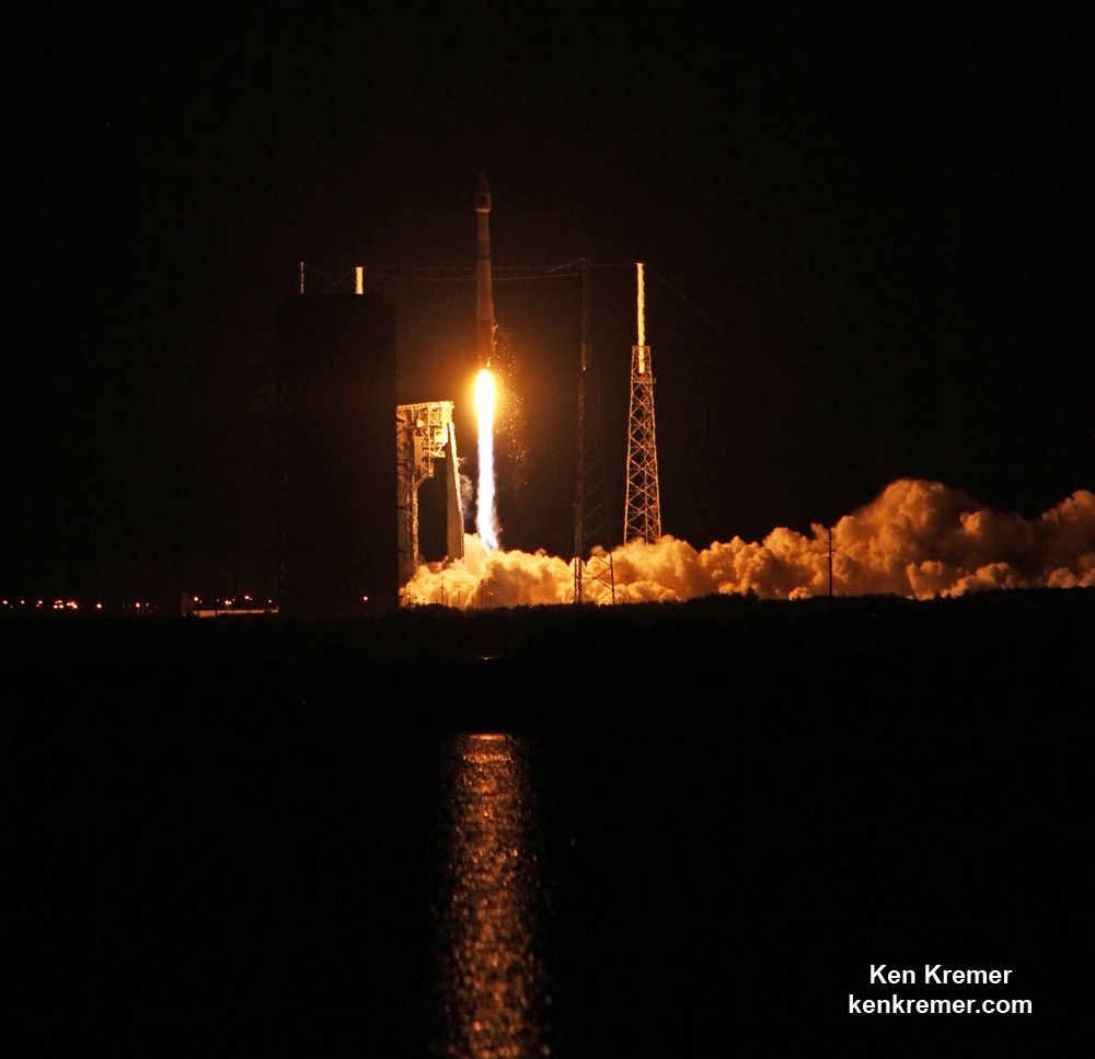
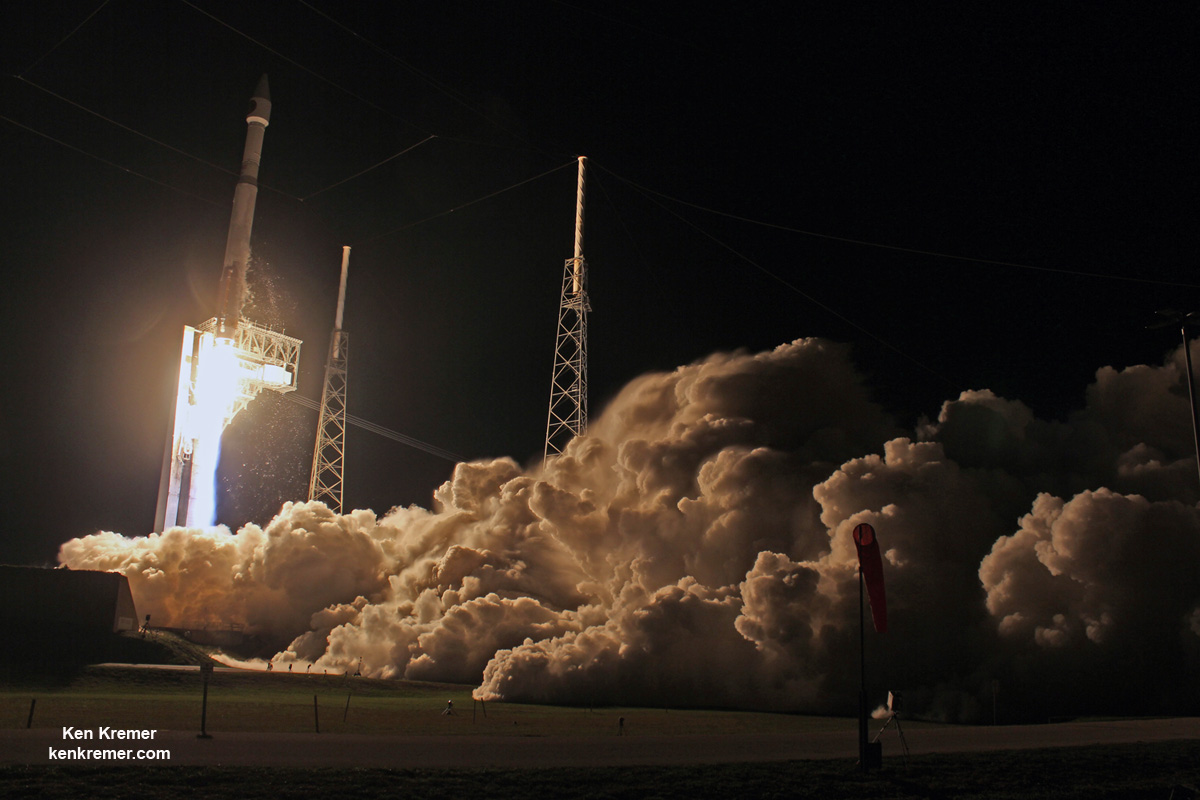
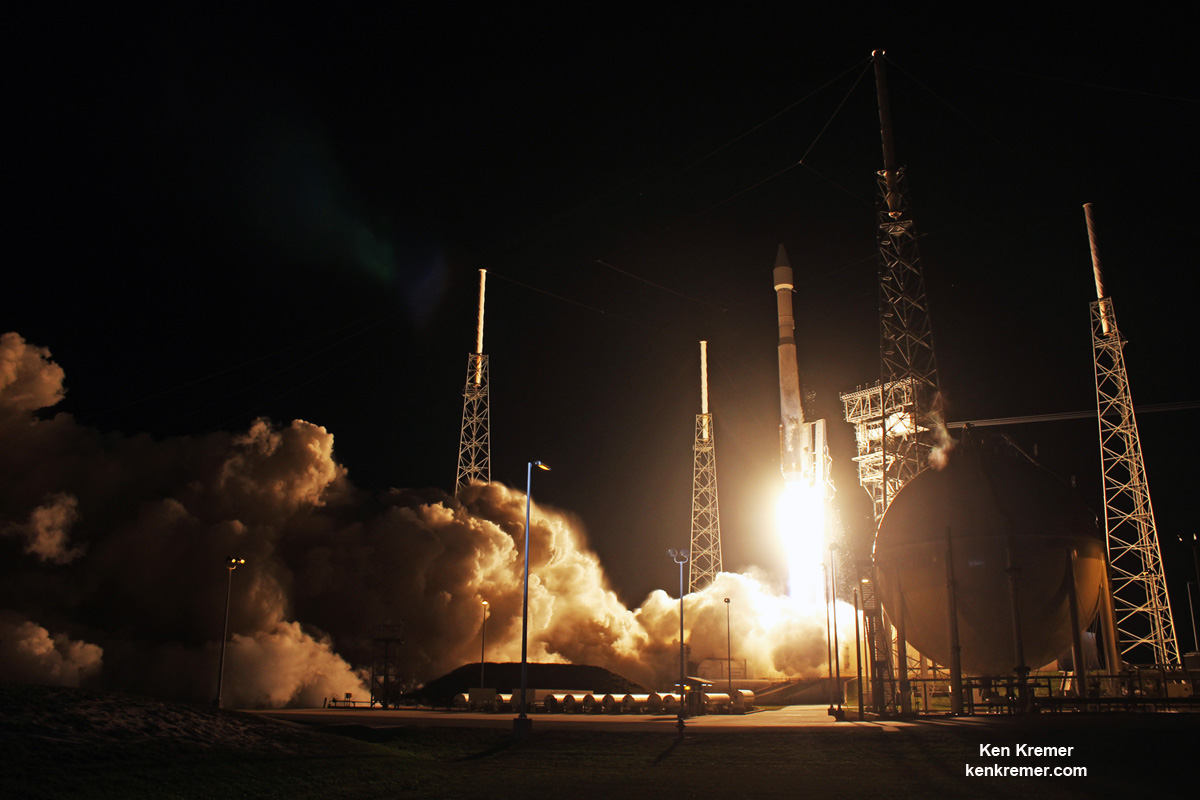
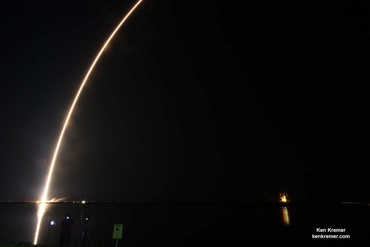
Vital Air Force Missile Reconnaissance Satellite SBIRS GEO 3 Launched – Photo/Video Gallery  United Launch Alliance (ULA) Atlas V rocket carrying SBIRS GEO Flight 3 early missile warning satellite for USAF lifts off at 7:42 p.m. ET on Jan. 20, 2017 from Space Launch Complex-41 on Cape Canaveral Air Force Station in Florida. Credit: Ken Kremer/kenkremer.com CAPE CANAVERAL AIR FORCE STATION, FL – A vital missile reconnaissance satellite for the U.S. Force soared to space atop an Atlas V rocket from Cape Canaveral at dinnertime Friday night, Jan. 20, 2017. The United Launch Alliance Atlas V rocket carrying the $1.2 Billion Space Based Infrared System (SBIRS) GEO Flight 3 infrared imaging satellite lifted off at 7:42 p.m. ET from Space Launch Complex-41 on Cape Canaveral Air Force Station, Fla. Check out this expanding gallery of eyepopping photos and videos from several space journalist colleagues and friends and myself – for views you won't see elsewhere. Click back as the gallery grows !  Nighttime blastoff of ULA Atlas V rocket carrying the USAF SBIRS GEO 3 missile defense satellite to orbit on Jan. 20, 2017 from Space Launch Complex-41 at Cape Canaveral Air Force Station in Florida. Credit: Julian Leek "GEO Flight 3 delivery and launch marks a significant milestone in fulfilling our commitment to the missile-warning community, missile defense and the intelligence community. It's an important asset for the warfighter and will be employed for years to come," says Lt. Gen. Samuel Greaves, SMC commander and Air Force program executive officer for space, in a statement. The Space Based Infrared System is designed to provide global, persistent, infrared surveillance capabilities to meet 21st century demands in four national security mission areas: missile warning, missile defense, technical intelligence and battlespace awareness. “The hard work and dedication of the launch team has absolutely paid off,” Col. Dennis Bythewood, director of the Remote Sensing Directorate said in a statement. “Today’s launch of GEO Flight 3 culminates years of preparation by a broad team of government and industry professionals.”  ULA Atlas V launch of USAF SBIRS GEO 3 missile defense satellite on Jan. 20, 2017 from Space Launch Complex-41 at Cape Canaveral Air Force Station in Florida. Credit: Joe Sekora The SBIRS GEO Flight 3 missile defense observatory built for the USAF will detect and track the infrared signatures of incoming enemy missiles twice as fast as the prior generation of satellites and is vital to America's national security.  United Launch Alliance (ULA) Atlas V rocket carrying SBIRS GEO Flight 3 missile detection satellite for USAF lifts off at 7:42 p.m. ET on Jan. 20, 2017 from Space Launch Complex-41 on Cape Canaveral Air Force Station in Florida. Credit: Ken Kremer/kenkremer.com
SBIRS GEO Flight 3 was launched to geosynchronous transfer orbit to an altitude approx 22,000 miles (36,000 kilometers) above Earth. The Atlas V was launched southeast at an inclination of 23.29 degrees. SBIRS GEO Flight 3 separated from the 2nd stage as planned 43 minutes after liftoff. Following separation, the spacecraft began a series of orbital maneuvers to propel it to a geosynchronous earth orbit. Once in its final orbit, engineers will deploy the satellite’s solar arrays and antennas. The engineers will then complete checkout and tests in preparation for operational use, USAF officials explained. Watch these eyepopping launch videos as the Atlas V rocket thunders to space – showing different perspectives of the blastoff from remote cameras ringing the pad and from the media's launch viewing site on Cape Canaveral Air Force Station. Video Caption: ULA Atlas 5 launch of the SBIRS GEO Flight 3 satellite from Pad 41 of the Cape Canaveral Air Force Station on January 20, 2017. Credit: Jeff Seibert Video Caption: Launch of SBIRS GEO Flight 3 early missile warning satellite for USAF on a United Launch Alliance (ULA) Atlas V rocket from SLC-41 on Cape Canaveral Air Force Station, Fl., at 7:42 p.m. ET on Jan. 20, 2017 – as seen in this remote video taken at the pad. Credit: Ken Kremer/kenkremer.com
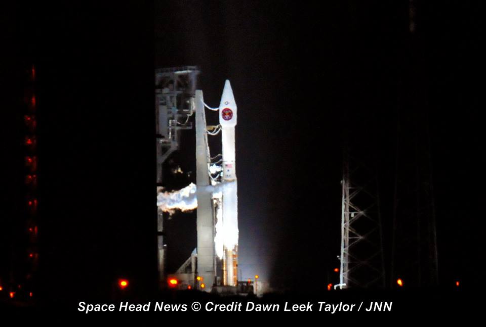
Lockheed Martin is the prime contractor, with Northrop Grumman as the payload integrator. The SBIRS team is led by the Remote Sensing Systems Directorate at the U.S. Air Force Space and Missile Systems Center. Air Force Space Command operates the SBIRS system.  United Launch Alliance (ULA) Atlas V rocket carrying SBIRS GEO Flight 3 early missile warning satellite for USAF lifts off at 7:42 p.m. ET on Jan. 20, 2017 from Space Launch Complex-41 on Cape Canaveral Air Force Station in Florida. Credit: Ken Kremer/kenkremer.com  ULA Atlas V rocket carrying SBIRS GEO Flight 3 missile tracking observatory lifts off at 7:42 p.m. ET on Jan. 20, 2017 from Space Launch Complex-41 on Cape Canaveral Air Force Station in Florida. Credit: Ken Kremer/kenkremer.com Stay tuned here for Ken’s continuing Earth and Planetary science and human spaceflight news. Ken Kremer  ULA Atlas V rocket carrying the USAF SBIRS GEO 3 missile warning satellite awaits blastoff from pad 41 at Cape Canaveral Air Force Station in Florida on Jan. 20 , 2017. Credit: Dawn Taylor  A United Launch Alliance (ULA) Atlas V rocket carrying SBIRS GEO Flight 3 satellite lifts off at 7:42 p.m. ET on Jan. 20, 2017 from Space Launch Complex-41 on Cape Canaveral Air Force Station in Florida. Credit: Ken Kremer/kenkremer.com
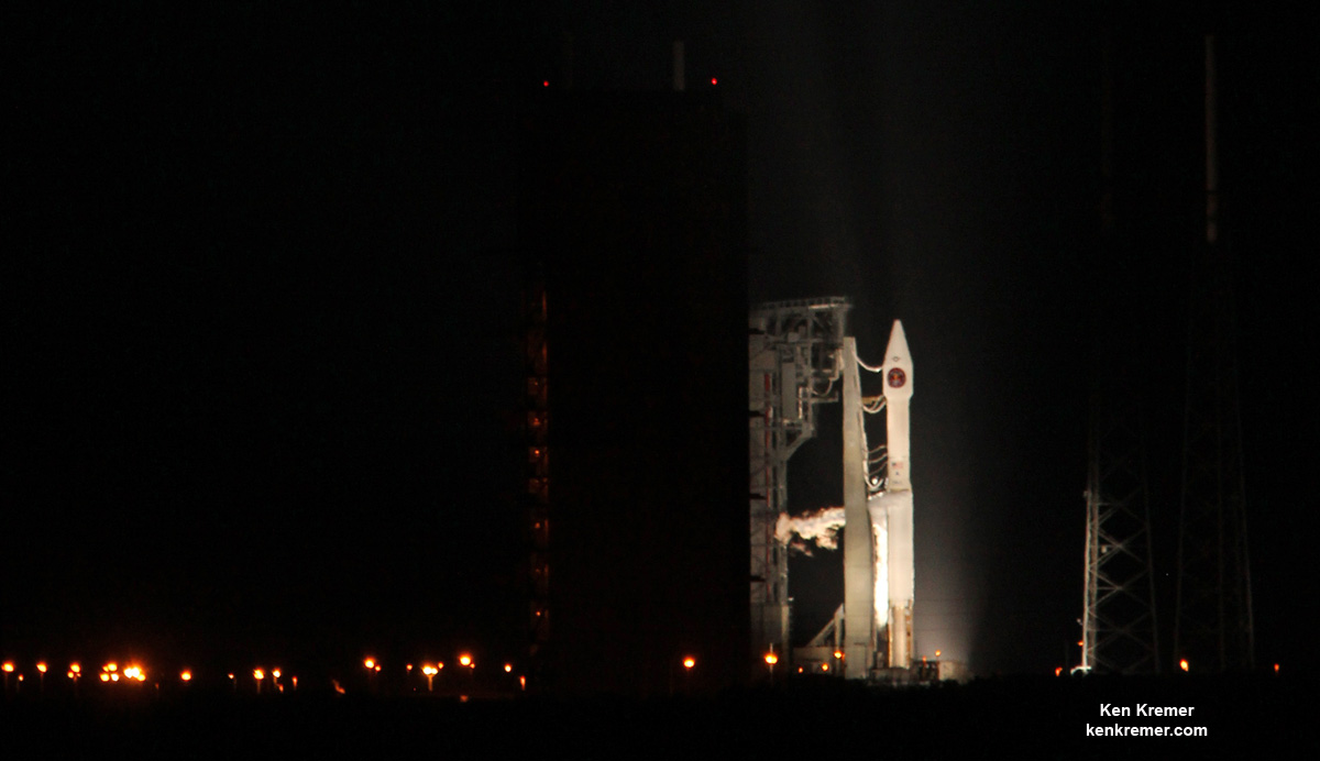
 ULA Atlas V rocket carrying the USAF SBIRS GEO 3 missile warning satellite awaits blastoff from pad 41 at Cape Canaveral Air Force Station in Florida on Jan. 20 , 2017. Credit: Ken Kremer/kenkremer.com
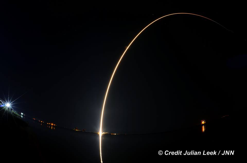
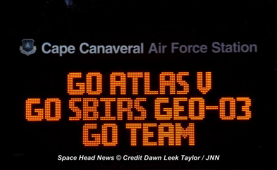
 ULA Atlas V rocket carrying the USAF SBIRS GEO 3 missile defense satellite streaks to orbit on Jan. 20, 2017 after nighttime blastoff at 7:42 p.m. ET from Space Launch Complex-41 at Cape Canaveral Air Force Station in Florida. Credit: Julian Leek  Banner announcing imminent launch of ULA Atlas V and USAF SBIRS GEO 3 from CCAFS on Jan. 20, 2017. Credit: Dawn Taylor
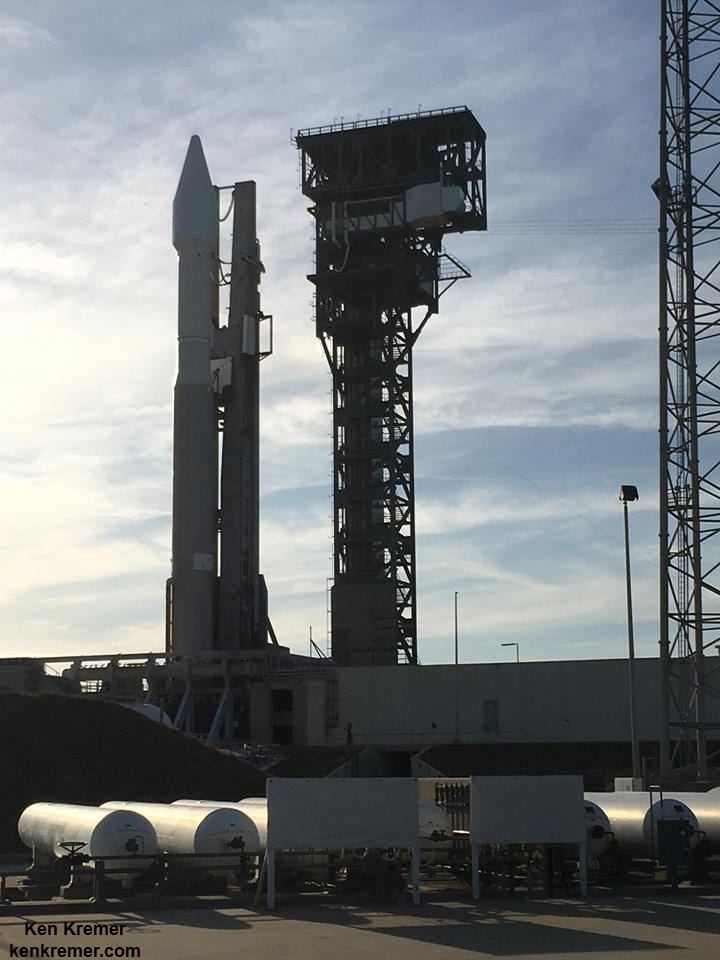
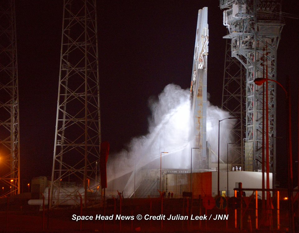
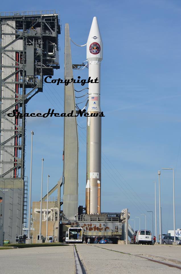
 Launch of Atlas V and USAF SBIRS GEO 3 missile defense satellite from CCAFS on Jan. 20, 2017 as seen from Titusville, Fl neighborhood. Credit: Melissa Bayles  ULA Atlas V rocket stands erect alongside newly built crew access tower at Cape Canaveral Air Force Station’s Space Launch Complex-41 ahead of Jan. 19, 2017 blastoff. Credit: Ken Kremer/kenkremer.com Launch of Atlas V and USAF SBIRS GEO 3 missile defense satellite from CCAFS on Jan. 20, 2017 as seen from Titusville, Fl neighborhood. Credit: Melissa Bayles  Pad 41 gets hosed down about 1 hour post launch of ULA Atlas V rocket delivering USAF SBIRS GEO 3 missile defense satellite to orbit on Jan. 20, 2017 from Space Launch Complex-41 at Cape Canaveral Air Force Station in Florida. Credit: Julian Leek  Atlas V/SBIRS GEO 3 awaits liftoff from pad 41 on Jan. 20, 2017 at Cape Canaveral Air Force Station in Florida. Credit: Lane Hermann The post Vital Air Force Missile Reconnaissance Satellite SBIRS GEO 3 Launched – Photo/Video Gallery appeared first on Universe Today.
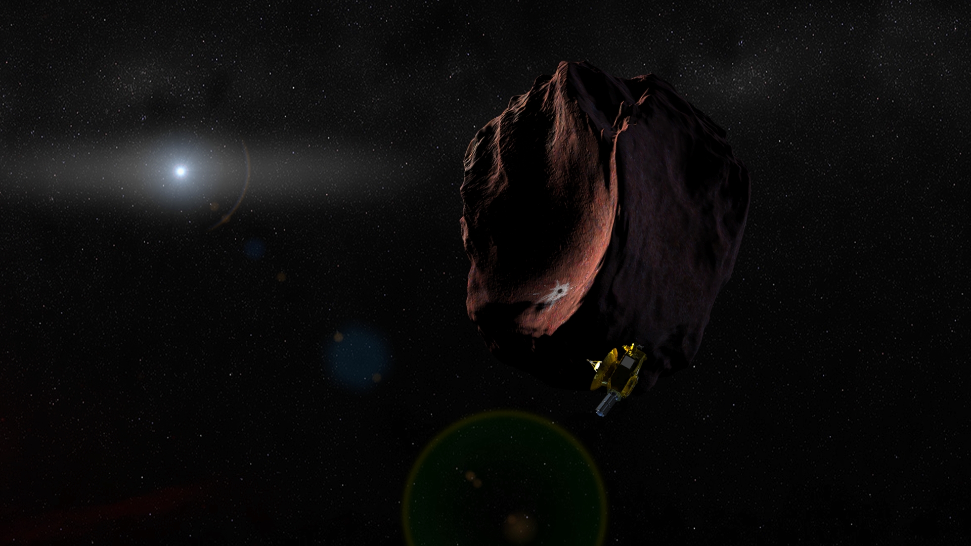
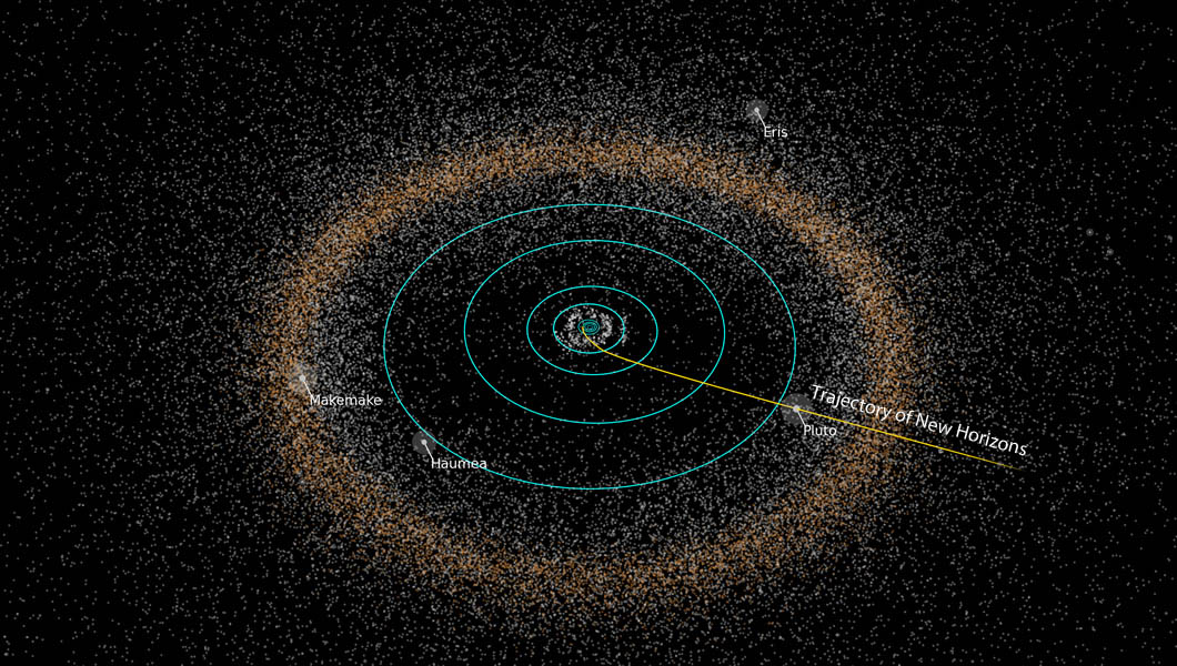
Here's the Highest Resolution Map of Pluto We'll Get from New Horizons On July 14th, 2015, the New Horizons mission made history by conducting the first flyby of Pluto. This represented the culmination of a nine year journey, which began on January 19th, 2006 – when the spacecraft was launched from the Cape Canaveral Air Force Station. And before the mission is complete, NASA hopes to send the spacecraft to investigate objects in the Kuiper Belt as well. To mark the 11th anniversary of the spacecraft’s launch, members of the New Horizons team took part in panel a discussion hosted by the Johns Hopkins University Applied Physics Laboratory (JHUAPL) located in Laurel, Maryland. The event was broadcasted on Facebook Live, and consisted of team members speaking about the highlights of the mission and what lies ahead for the NASA spacecraft. The live panel discussion took place on Thursday, Sept. 19th at 4 p.m. EST, and included Jim Green and Alan Stern – the director the Planetary Science Division at NASA and the principle investigator (PI) of the New Horizons mission, respectively. Also in attendance was Glen Fountain and Helene Winters, New Horizons‘ project managers; and Kelsi Singer, the New Horizons co-investigator.  Artist’s concept of the New Horizons spacecraft encountering a Kuiper Belt object, part of an extended mission after the spacecraft's July 2015 Pluto flyby. Credits: NASA/JHUAPL/SwRI In the course of the event, the panel members responded to questions and shared stories about the mission’s greatest accomplishments. Among them were the many, many high-resolution photographs taken by the spacecraft’s Ralph and Long Range Reconnaissance Imager (LORRI) cameras. In addition to providing detailing images of Pluto’s surface features, they also allowed for the creation of the very first detailed map of Pluto. Though Pluto is not officially designated as a planet anymore – ever since the XXVIth General Assembly of the International Astronomical Union, where Pluto was designated as a “dwarf planet” – many members of the team still consider it to be the ninth planet of the Solar System. Because of this, New Horizons‘ historic flyby was of particular significance. As Principle Investigator Alan Stern – from the Southwestern Research Institute (SwRI) – explained in an interview with Inverse, the first phase of humanity’s investigation of the Solar System is now complete. "What we did was we provided the capstone to the initial exploration of the planets,” he said. “All nine have been explored with New Horizons finishing that task." Other significant discoveries made by the New Horizons mission include Pluto’s famous heart-shaped terrain – aka. Sputnik Planum. This region turned out to be a young, icy plain that contains water ice flows adrift on a “sea” of frozen nitrogen. And then there was the discovery of the large mountain and possible cryovolcano located at the tip of the plain – named Tombaugh Regio, (in honor of Pluto’s discovered, Clyde Tombaugh).  New Horizons path from the inner Solar System to Pluto and the Kuiper Belt. Credit: NASA/JHUAPL The mission also revealed further evidence of geological activity and cryovolcanism, the presence of hyrdocarbon clouds on Pluto, and conducted the very first measurements of how Pluto interacts with solar wind. All told, over 50 gigabits of data were collected by New Horizons during its encounter and flyby with Pluto. And the detailed map which resulted from it did a good job of capturing all this complexity and diversity. As Stern explained: "That really blew away our expectations. We did not think that a planet the size of North America could be as complex as Mars or even Earth. It's just tons of eye candy. This color map is the highest resolution we will see until another spacecraft goes back to Pluto." After making its historic flyby of Pluto, the New Horizons team requested that the mission receive an extension to 2021 so that it could explore Kuiper Belt Objects (KBOs). This extension was granted, and for the first part of the Kuiper Belt Extended Mission (KEM), the spacecraft will perform a close flyby of the object known as 2014 MU69. This remote KBO – which is estimated to be between 25 – 45 km (16-28 mi) in diameter – was one of two objects identified as potential targets for research, and the one recommended by the New Horizons team. The flyby, which is expected to take place in January of 2019, will involve the spacecraft taking a series of photographs on approach, as well as some pictures of the object’s surface once it gets closer. Before the extension ends in 2021, it will continue to send back information on the gas, dust and plasma conditions in the Kuiper Belt. Clearly, we are not finished with the New Horizons mission, and it is not finished with us! To check out footage from the live-streamed event, head on over to the New Horizons Facebook page. Further Reading: NASA The post Here’s the Highest Resolution Map of Pluto We’ll Get from New Horizons appeared first on Universe Today.
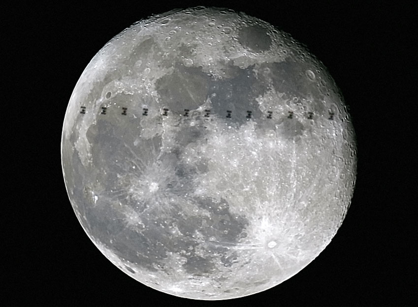
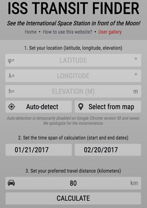
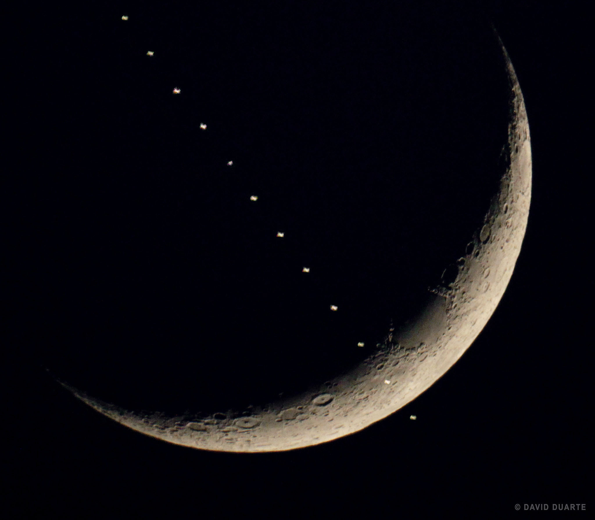
How to See the Space Station Fly in Front of the Moon  What strange creature is this flitting across the Moon? Several members of the European Space Agency’s Astronomy Center captured these views of the International Space Station near Madrid, Spain on January 14 as it flew or transited in front of the full moon. Credit: Michel Breitfellner, Manuel Castillo, Abel de Burgos and Miguel Perez Ayucar / ESA One-one thou… That’s how long it takes for the International Space Station, traveling at over 17,000 mph (27,300 kph), to cross the face of the Full Moon. Only about a half second! To see it with your own eyes, you need to know exactly when and where to look. Full Moon is best, since it’s the biggest the moon can appear, but anything from a half-moon up and up will do. The photo above was made by superimposing 13 separate images of the ISS passing in front of the Moon into one. Once the team knew when the pass would happen, they used a digital camera to fire a burst of exposures, capturing multiple moments of the silhouetted spacecraft. The ISS transits the Full Moon in May 2016 The ISS is the largest structure in orbit, spanning the size of a football field, but at 250 miles (400 km) altitude, it only appears as big as a modest lunar crater. While taking a photo sequence demands careful planning, seeing a pass is bit easier. As you’d suspect, the chances of the space station lining up exactly with a small target like the Moon from any particular location is small. But the ISS Transit Finder makes the job simple.  This is a screen grab from the homepage of Bartosz Wojczy?ski’s most useful ISS Transit Finder. Credit: Bartosz Wojczy?ski Click on the link and fill in your local latitude, longitude and altitude or select from the Google maps link shown. You can always find your precise latitude and longitude at NASA’s Latitude/Longitude Finder and altitude at Google Maps Find Altitude. Next, set the time span of your Moon transit search (up to one month from the current date) and then how far you’re willing to drive to see the ISS fly in front of the Moon. When you click Calculate, you’ll get a list of events with little diagrams showing where the ISS will pass in relation to the Moon and sun (yes, the calculator also does solar disk crossings!) from your location. Notice that most of the passes will be near misses. However, if you click on the Show on Map link, you’ll get a ground track of exactly where you will need to travel to see it squarely cross Moon or Sun.  A beautiful ISS transit on June 19 2015 recorded at Biscarrosse, France. The photographer used CalSky, another excellent satellite site, to prepare a week in advance of the event. This composite image was made with a Canon EOS 60D. Notice how bright the space station appears against the moon due to the lower-angled lighting across the lunar landscape at crescent phase compared to full, when the ISS appears in silhouette. Credit: David Duarte The map also includes Recalculate for this location link. Clicking that will show you a sketch of the ISS’ predicted path across the Moon from the centerline location along with other details. I checked my city, and while there are no lunar transits for the next month, there’s a very nice solar one visible just a few miles from my home on Feb. 8. Remember to use a safe solar filter if you plan on viewing one of these!  The ISS transits the Sun on May 3, 2016. Click for details on how the photo was taken. Credit: Szabolcs Nagy While you might attempt to see a transit of the ISS in binoculars, your best bet is with a telescope. Nothing fancy required, just about any size will do so long as it magnifies at least 30x to 40x. Timing is crucial. Like an occultation, when the moon hides a background star in an instant, you want to be on time and 100% present. Make sure you’re set up and focused on the moon or sun (with filter) at least 5 minutes beforehand. Keep your cellphone handy. I’ve found the time displayed at least on my phone to be accurate. One minute before the anticipated transit, glue your eye to the eyepiece, relax and wait for the flyby. Expect something like a bird in silhouette to make a swift dash across the moon’s face. The video above will help you anticipate what to expect.  The next lunar transit nearest my home is an hour and a half away in the small town of Biwabik, Minn. according to the ISS Transit Finder. On Jan. 30 at 8:00:08 p.m local time, the ISS will cross the crescent moon from there. Once you know the time of the prediction and the exact latitude and longitude of the location (all information shown in the info box on the map using the ISS Transit Finder), you can turn on the satellites feature in the free Stellarium program (stellarium.org), select the ISS and create a simulated, detailed path. Created with Stellarium Even if you never go to the trouble of identifying a “direct hit”, you can still use the transit finder to compile a list of cool lunar close approaches that would make for great photos with just a camera and tripod. The Transit Finder isn’t the only way to predict ISS flybys. Some observers also use the excellent satellite site, CalSky. Once you tell it your location, select the Lunar/Solar Disk Crossings and Occultations link for lots of information including times, diagrams of crossings, ground tracks and more. I use Stellarium (above) to make nifty simulated paths and show me where the Moon will be in the sky at the time of the transit. When you’ve downloaded the free program, get the latest satellite orbital elements this way: * Move you cursor to the lower left of the window and select the Configuration box
* Click the Plugins tab and scroll down to Satellites and click Configure and then Update
* Hover the cursor at the bottom of the screen for a visual menu. Slide over to the satellite icon and click it once for Satellite hints. The ISS will now be active.
* Set the clock and location (lower left again) for the precise time and location, then do a search for the Moon, and you’ll see the ISS path. There you have it — lots of options. Or you can simply use the Transit Finder and call it a day! I hope you’ll soon be in the right place at the right time to see the space station pass in front of the Moon. Checking my usual haunts, I see that the space station will be returning next weekend (Jan. 27) to begin an approximately 3-week run of easily viewable evening passes. The post How to See the Space Station Fly in Front of the Moon appeared first on Universe Today.
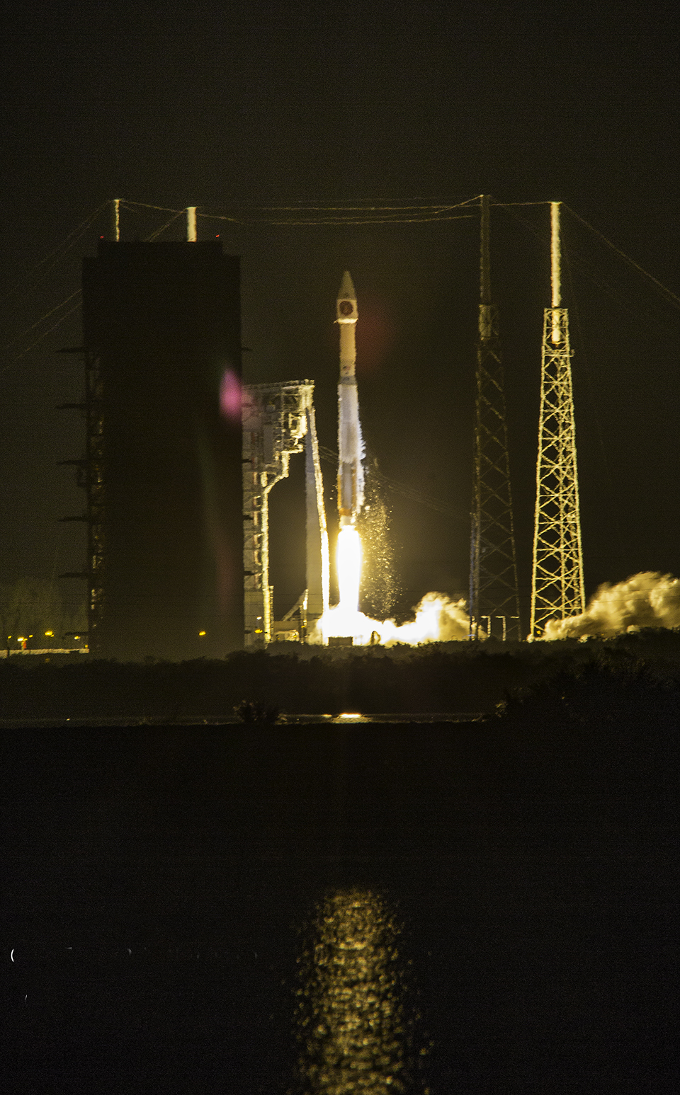
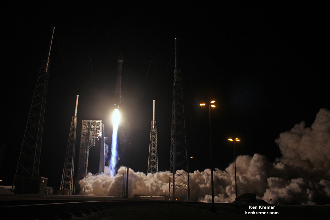
USAF Missile Defense SBIRS Observatory Streaks to Orbit during Spectacular Evening Blastoff  ULA Atlas V rocket carrying the USAF SBIRS GEO 3 missile defense satellite streaks to orbit on Jan. 20, 2017 after nighttime blastoff at 7:42 p.m. ET from Space Launch Complex-41 at Cape Canaveral Air Force Station in Florida. Credit: Ken Kremer/kenkremer.com CAPE CANAVERAL AIR FORCE STATION, FL – A U.S. Air Force missile defense reconnaissance observatory that will track the telltale infrared signatures of incoming enemy missiles and is vital to America's national security blasted off in spectacular fashion this evening, Jan. 20, 2017, as it streaked to orbit from the Florida Space Coast. The United Launch Alliance Atlas V rocket carrying the $1.2 Billion Space Based Infrared System (SBIRS) GEO Flight 3 infrared imaging satellite lifted off at 7:42 p.m. ET from Space Launch Complex-41 on Cape Canaveral Air Force Station, Fla. – marking the first US east coast launch of 2017. The SBIRS GEO Flight 3 was launched to geosynchronous transfer orbit to an altitude approx 22,000 miles (36,000 kilometers) above Earth. The Atlas V was launched southeast at an inclination of 23.29 degrees. SBIRS GEO Flight 3 separated from the 2nd stage as planned 43 minutes after liftoff. It is also the first of at least eleven launches of Atlas and Delta rockets by the aerospace firm this year. The on time launch took place at the opening of the 40 minute launch window and after a 24 hour delay – when the launch was scrubbed yesterday (Jan. 19) after an aircraft flew into the Cape's restricted airspace and could not be diverted in time before the launch window closed. ULA also had to address sensor issues with the Atlas rockets RD-180 main engine during Thursday's countdown. Due to the scrub, the Atlas liftoff counts as the first launch of the Trump Administration rather the last of the Obama Administration. With the unpredictable North Korean dictator Kim John Un threatening to launch an upgraded long range intercontinental ballistic missile this year that could potentially strike the United States west coast, SBIRS GEO 3 is more important than ever for our national defense. ULA Atlas V rocket carrying the USAF SBIRS GEO 3 missile defense satellite streaks to orbit on Jan. 20, 2017 after nighttime blastoff at 7:42 p.m. ET from Space Launch Complex-41 at Cape Canaveral Air Force Station in Florida. Credit: Julian Leek The SBIRS GEO Flight 3 is considered to be one of the highest priority military space programs in defense of the homeland. The Space Based Infrared System is designed to provide global, persistent, infrared surveillance capabilities to meet 21st century demands in four national security mission areas: missile warning, missile defense, technical intelligence and battlespace awareness. SBIRS will supplement and replace the legacy Defense Support Program (DSP) satellites currently in orbit and features vastly increased early missile detection and warning capabilities. "ULA is proud to deliver this critical satellite which will improve surveillance capabilities for our national decision makers," said Laura Maginnis, ULA vice president of Government Satellite Launch, in a statement. "I can't think of a better way to kick off the new year." A United Launch Alliance (ULA) Atlas V rocket carrying SBIRS GEO Flight 3 satellite lifts off at 7:42 p.m. ET on Jan. 20, 2017 from Space Launch Complex-41 on Cape Canaveral Air Force Station in Florida. Credit: Ken Kremer/kenkremer.com
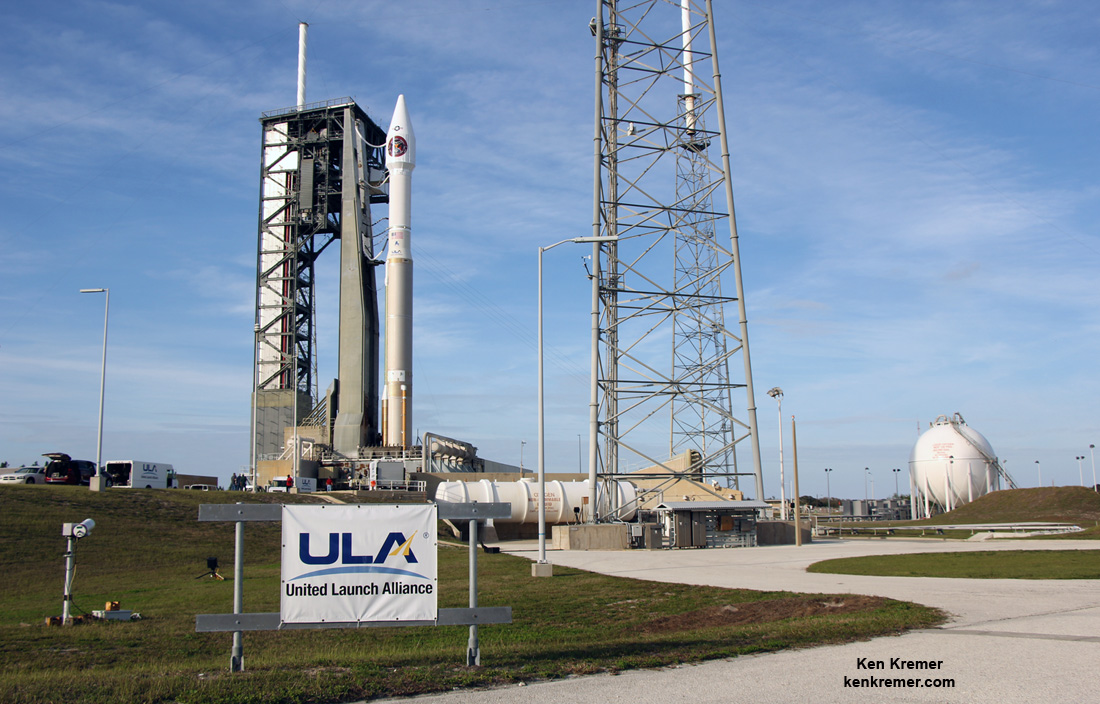
ULA is a joint venture of Boeing and Lockheed Martin with 116 successful launches under its belt after today's liftoff. The 194-foot-tall commercial Atlas V booster launched in the 401 rocket configuration with approximately 860,000 pounds of sea level first stage thrust powered by the dual nozzle Russian-built RD AMROSS RD-180 engine. There are no thrust augmenting solids attached to the first stage. The satellite is housed inside a 4-meter diameter large payload fairing (LPF). The Centaur upper stage is powered by the Aerojet Rocketdyne RL10C engine. Watch this video showing the detailed mission profile: Video Caption: An Atlas V 401 configuration rocket will deliver the Air Force’s third Space-Based Infrared System (SBIRS) satellite to orbit. SBIRS, considered one of the nation’s highest priority space programs, is designed to provide global, persistent, infrared surveillance capabilities to meet 21st century demands. Credit: ULA This mission marks the 34th Atlas V mission in the 401 configuration. "The Atlas V 401 configuration has become the workhorse of the Atlas V fleet, delivering half of all Atlas V missions to date" said Maginnis. "ULA understands that even with the most reliable launch vehicles, our sustained mission success is only made possible with seamless integration between our customer and our world class ULA team." ULA Atlas V rocket carrying SBIRS GEO Flight 3 missile tracking observatory lifts off at 7:42 p.m. ET on Jan. 20, 2017 from Space Launch Complex-41 on Cape Canaveral Air Force Station in Florida. Credit: Ken Kremer/kenkremer.com The two prior SBIRS GEO missions also launched on the ULA Atlas V 401 rocket. The SBIRS team is led by the Remote Sensing Systems Directorate at the U.S. Air Force Space and Missile Systems Center. Lockheed Martin is the prime contractor, with Northrop Grumman as the payload integrator. Air Force Space Command operates the SBIRS system, according to a ULA description. Stay tuned here for Ken’s continuing Earth and Planetary science and human spaceflight news. Ken Kremer  ULA Atlas V rocket carrying the USAF SBIRS GEO 3 missile warning satellite is poised for blastoff from Space Launch Complex-41 at Cape Canaveral Air Force Station in Florida on Jan. 20, 2017. Credit: Ken Kremer/kenkremer.com
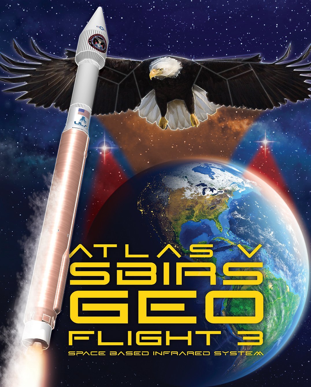
 Artwork for ULA Atlas V launch of SBIRS GEO Flight 3 mission on Jan. 19, 2017 from Canaveral Air Force Station, Florida. Credit: ULA The post USAF Missile Defense SBIRS Observatory Streaks to Orbit during Spectacular Evening Blastoff appeared first on Universe Today.
The Carina Constellation Welcome back to Constellation Friday! Today, in honor of the late and great Tammy Plotner, we will be dealing with the “keel of the ship”, the Carina constellation!
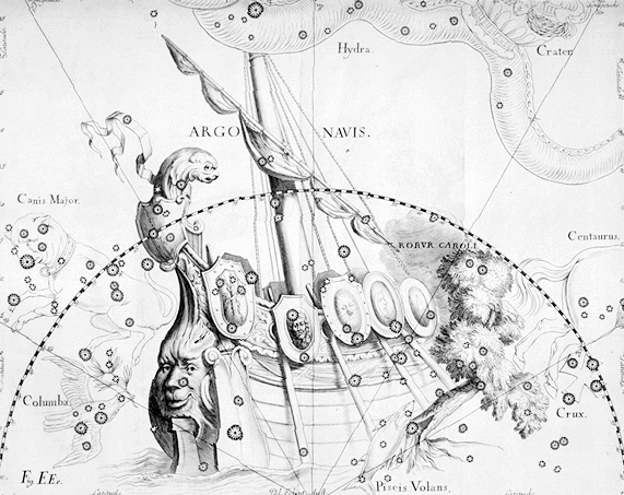
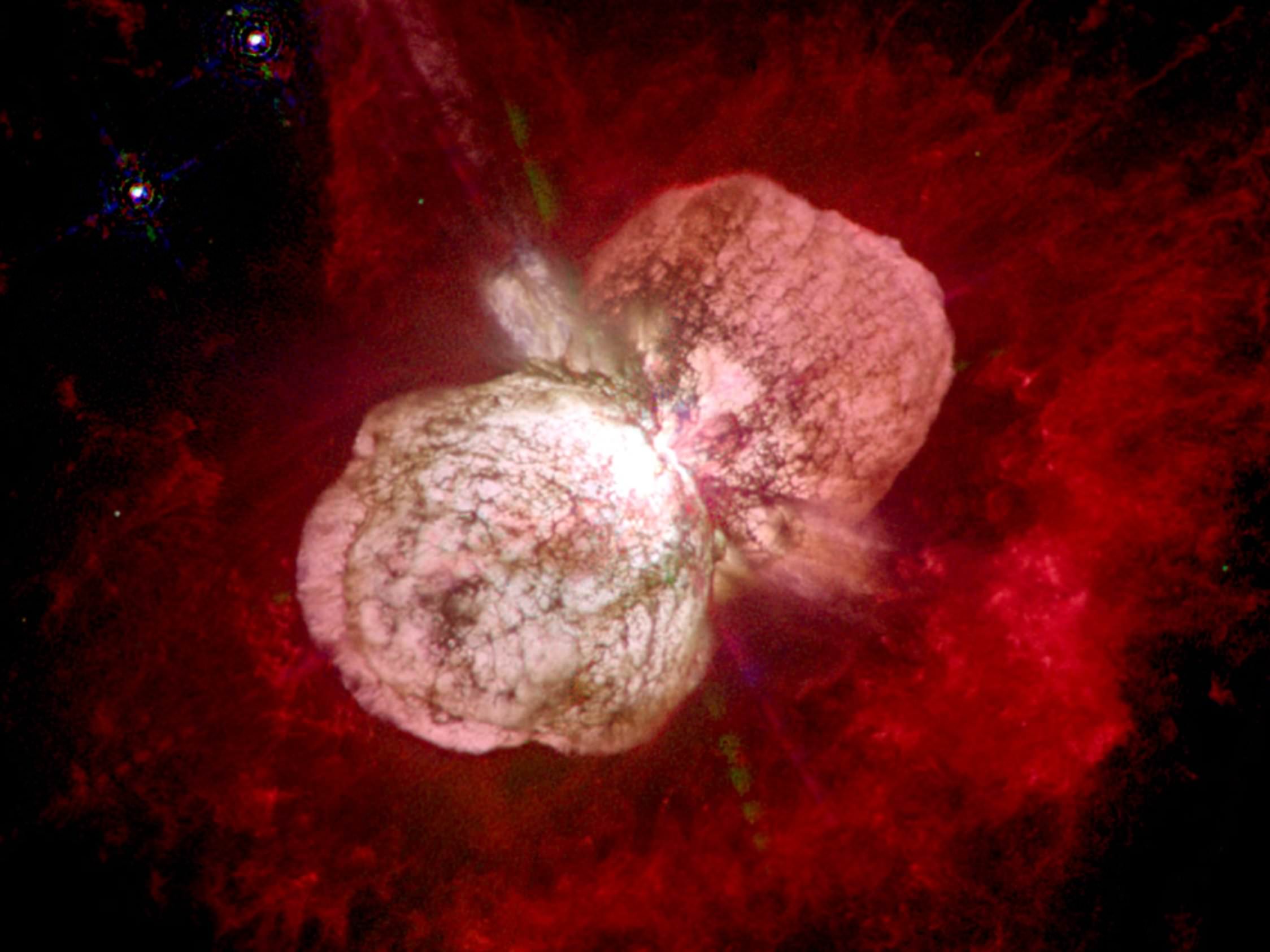
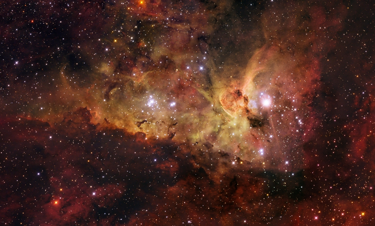
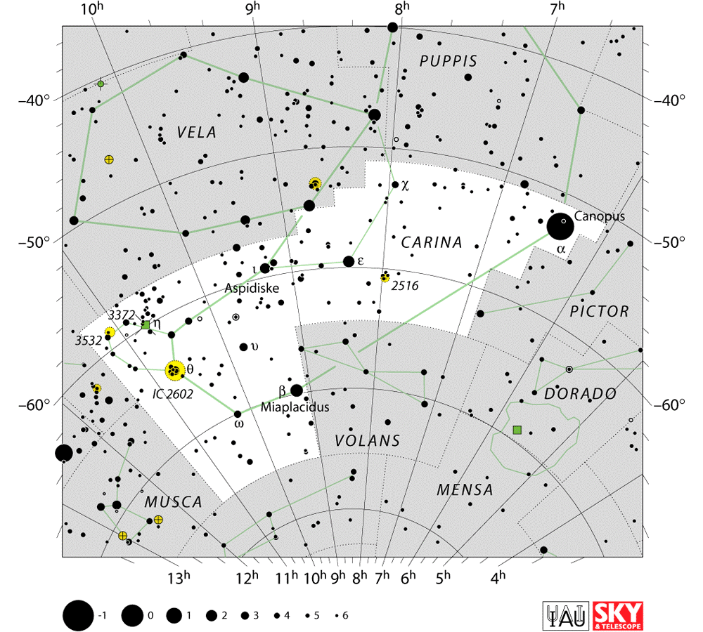
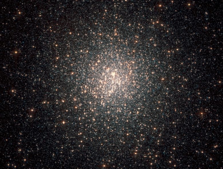
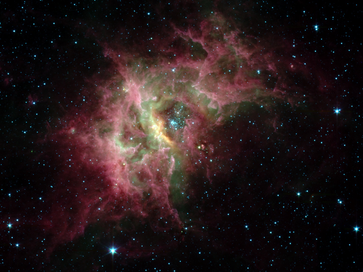
In the 2nd century CE, Greek-Egyptian astronomer Claudius Ptolemaeus (aka. Ptolemy) compiled a list of all the then-known 48 constellations. This treatise, known as the Almagest, would used by medieval European and Islamic scholars for over a thousand years to come, effectively becoming astrological and astronomical canon until the early Modern Age. One of these constellations, known as Argo Navis, would eventually be divided into three asterism – one of which became the southern constellations of Carina. Bordered by the Vela, Puppis, Pictor, Volans, Chamaeleon, Musca and Centaurus constellations, Carina is one of 88 modern constellations that are currently recognized by the IAU. Name and Meaning: The stellar southern constellation Carina is part of the ancient constellation known as Argo Navis. It is now abbreviated and represents the “Keel”. While Carina has no real mythological connection, since its stars weren’t visible to the ancient Greeks and Romans, it does have a fascinating history. Argo Navis (or simply Argo) was a large southern constellation representing the Argo, the ship used by Jason and the Argonauts in Greek mythology.  Johannes Hevelius’ Argo Navis from Uranographia (1690). Credit: NASA/Chandra/Harvard University The Argo was built by the shipwright Argus, and its crew were specially protected by the goddess Hera. The best source for the myth is the Argonautica by Apollonius Rhodius. According to a variety of sources of the legend, the Argo was said to have been planned or constructed with the help of Athena. According to other legends it contained in its prow a magical piece of timber from the sacred forest of Dodona, which could speak and render prophecies. After the successful journey, the Argo was consecrated to Poseidon in the Isthmus of Corinth. It was then translated into the sky and turned into the constellation of Argo Navis. The abbreviation for it was “Arg”, and the genitive was “Argus Navis”. History of Observation: Carina is the only one of Ptolemy’s list of 48 constellations that is no longer officially recognized as a constellation. In 1752, French astronomer Nicolas Louis de Lacaille subdivided Argo Navis into Carina (the keel of the ship), Puppis (the Poop deck), and Vela (the sails). Were this still considered to be a single constellation, it would be the largest of all, being larger than Hydra. When Argo Navis was split, its Bayer designations were also split. Whereas Carina got the Alpha, Beta and Epsilon stars, Vela got Gamma and Delta, Puppis got Zeta, and so on. The constellation Pyxis occupies an area which in antiquity was considered part of Argo’s mast. However, Pyxis is not typically considered part of Argo Navis, and in particular its Bayer designations are separate from those of Carina, Puppis and Vela.  Canopus (alpha Carinae), the brightest star in the Carina constellation and the second brightest star in the night sky. Credit: NASA Notable Features: The Carina constellation consists of 9 primary stars and has 52 Bayer/Flamsteed designated stars. It’s alpha star, Canopus, is not only he brightest star in the constellation, but the second brightest in the night sky (behind Sirius). This F-type giant is 13,600 times brighter than our Sun, with an apparent visual magnitude of -0.72 and an absolute magnitude of -5.53. The name is the Latinized version of the Greek name Kanobos, presumably derived from the pilot of the shop that took Menelaus of Sparta to Troy to retrieve Helen in The Iliad. It is also known by its Arabic name, Suhail, which is derived from the Arabic name for several bright stars. Before the launching of the Hipparcos satellite telescope, distance estimates for the star varied widely, from 96 light years to 1200 light years. Had the latter distance been correct, Canopus would have been one of the most powerful stars in our galaxy. Hipparcos established Canopus as lying 310 light years (96 parsecs) from our solar system; this is based on a parallax measurement of 10.43 ± 0.53 mas. The difficulty in measuring Canopus’ distance stemmed from its unusual nature. Canopus is too far away for Earth-based parallax observations to be made, so the star’s distance was not known with certainty until the early 1990s. Canopus is 15,000 times more luminous than the Sun and the most intrinsically bright star within approximately 700 light years.  Sky as seen from central South America showing the approximate location of the new comet on August 19 in Puppis near the bright star Canopus. Credit: Stellarium For most stars in the local stellar neighborhood, Canopus would appear to be one of the brightest stars in the sky. Canopus is outshone by Sirius in our sky only because Sirius is far closer to the Earth (8 light years). Its surface temperature has been estimated at 7350 ± 30 K and its stellar diameter has been measured at 0.6 astronomical units 65 times that of the sun. If it were placed at the centre of the solar system, it would extend three-quarters of the way to Mercury. An Earth-like planet would have to lie three times the distance of Pluto! Canopus is part of the Scorpius-Centaurus Association, a group of stars which share similar origins. Next up is Miaplacidus (beta Carinae), an A-type subgiant located approximately 111 light years from Earth. It is the second brightest star in the constellation and the 29th brightest star in the sky. The star's name means "placid waters”, which is derived from the combination of the Arabic word for waters (miyah) and the Latin word for placid (placidus). Then there’s Eta Carinae, a luminous blue variable (LBV) binary star that is between 7,500 and 8,000 light years distant from Earth. The combined luminosity of this system is four million times that of our Sun, and the most massive star in the system has between 120 and 250 Solar Masses. It is sometimes known by its traditional names, Tseen She ("heaven's altar" in Chinese) and Foramen.  Eta Carinae, one of the most massive stars in the known Universe. Credit: NASA Also, it is believed that Eta Carinae will explode in the not-too-distant future, and it will be the most spectacular supernovae humans have ever seen. This supernova (or hypernova) might even affect Earth, since the star is only 7,500 light years away, causing disruption to the upper layers of the atmosphere, the ozone layer, satellites, and spacecraft could be damaged and any astronauts who happen to be in space could be injured. Avior (epsilon Carinae) is another double star system, consisting of a K0 III class orange giant and a hot hydrogen-fusing B2 V blue dwarf. With an apparent magnitude of 1.86 and is 630 light years distant, it is the 84th brightest star in the sky. The name Avior was assigned in the late 1930s by Her Majesty's Nautical Almanac Office as a navigational aid, at the request of the Royal Air Force. Aspidiske (aka. Iota Carinae) is a rare spectral type A8 Ib white supergiant located 690 light years from Earth. With a luminosity of 4,900 Suns (and seven Solar Masses), it is the 68th brightest star in the sky and is estimated to be around 40 million years old. It is known by the names Aspidiske, Turais and Scutulum, all diminutives of the word "shield," (in Greek, Arabic and Latin, respectively). Since the Milky Way runs through Carina, there are a large number of Deep Sky Objects associated with it. For instance, there’s the Carina Nebula (aka. the Eta Carinae Nebula, NGC 3372), a large nebula surrounding the massive stars Eta Carinae and HD 93129A. In addition to being four time as bright as the Orion Nebula (Messier 42), it is one of the largest diffuse nebulae known.  The Eta Carinae Nebula, one of the largest nebulae in the known Universe. Credit: ESO, IDA, Danish 1.5 m, R. Gendler, J-E. Ovaldsen, C. Thöne, and C. Feron The nebula is between 6,500 and 10,000 light years from Earth, and has an apparent visual magnitude of 1.0. It contains several O-type stars (extremely luminous hot, bluish stars, which are very rare). The first recorded observation of this nebula was made by the French astronomer Nicolas Louis de Lacaille in 1751-52, who observed it from the Cape of Good Hope. The Carina Nebula contains two smaller nebulae – the Homunculus Nebula and the Keyhole Nebula. The Keyhole Nebula – a small, dark cloud of dust and with bright filaments of fluorescent gas, was named by John Herschel in the 19th century. It is about seven light years in diameter, and appears contrasted against the bright nebula in the background. The Homunculus Nebula (Latin for “Little Man”) is an emission nebula embedded within the Eta Carinae Nebula, immediately surrounding the star Eta Carinae. The nebula is believed to have formed after an enormous outburst from the star, which coincided with Eta Carinae becoming the second brightest star in the night sky. The light of this outburst was visible from Earth by 1841. There’s also the Theta Carinae Cluster (aka. the Southern Pleiades, because of its resemblance to the Pleiades cluster. This open cluster was discovered by Lacaille in 1751, is located approximately 479 light years from Earth and is visible to the naked eye. The brightest star in the cluster, as the name indicates, is Theta Carinae, a blue-white dwarf.  The Keyhole Nebula, part of the larger Carina Nebula. Credit: NASA/The Hubble Heritage Team (AURA, STScI) Then there’s the Wishing Well Cluster (aka. NGC 3532), an open cluster in Carina. Approximately 1,321 light years distant, the cluster is composed of about 150 stars that appear through a telescope like silver coins twinkling at the bottom of a wishing well. The cluster lies between the constellation Crux (the Southern Cross) and the False Cross asterism in Carina and Vela, and was first object observed by the Hubble Space Telescope in May 1990. Finding Carina: Carina is the 34th largest constellation in the sky, occupying an area of 494 square degrees. It lies in the second quadrant of the southern hemisphere (SQ2) and is visible at latitudes between +20° and -90° and is best seen during the month of March. Before you even begin with a telescope or binoculars, be sure to stop and just take a good look at Alpha Carinae – Canopus. Canopus is essentially white when seen with the naked eye (though F-type stars are sometimes listed as “yellowish-white”). The spectral classification for Canopus is F0 Ia (Ia meaning “bright supergiant”), and such stars are rare and poorly understood; they are stars that can be either in the process of evolving to or away from red giant status. This in turn made it difficult to know how intrinsically bright Canopus is, and therefore how far away it might be. Since the Milky Way runs through Carina, there are a large number of open clusters in the constellation, making it a binocular observing paradise. NGC 2516 is a magnitude 3.1 open cluster originally discovered by Abbe Lacaille in 1751 with a 1/2″ spyglass. This gorgeous 30 arc minute spread of stars is also known as Caldwell 96 and graces many observing lists, including the Astronomical League Open Cluster, Deep Sky and Southern Observing Clubs.  Location of the Carina Constellation in the southern skies. Credit: IAU/Sky&Telescope magazine It is commonly known as the “Southern Beehive Cluster” (for it does resemble northern Messier 44) and it contains about 100 stars the brightest of which is an fifth magnitude red giant that lies near the center. As far as stellar age goes, this star cluster is very young – only about 140 million years old! Now hop to IC 2602, popularly known as the “Southern Pleiades” for is resemblance to northern Messier 45. This galactic cluster contains more than 50 stars and is approximately 500 light years away from Earth. At its heart is blue-white star Theta Carinae, and it can be found by forming a triangle in the sky with Beta and Iota Carinae. With a stellar magnitude of 2.0, this object is easily seen as a nebulous patch to the unaided eye! Another nebula that can been seen unaided but is better in binoculars is the Homunculus, an emission nebula surrounding the massive star Eta Carinae. The nebula is embedded within a much larger H II region, the Eta Carinae Nebula. Even though Eta Carinae is about 7,500 light-years away, structures only 10 billion miles across (about the diameter of our solar system) can be distinguished. Dust lanes, tiny condensations, and strange radial streaks all appear with unprecedented clarity. Excess violet light escapes along the equatorial plane between the bipolar lobes. While there is relatively little dusty debris between the lobes down by the star; most of the blue light is able to escape. The lobes, on the other hand, contain large amounts of dust which absorb blue light, causing the lobes to appear reddish.  The gas pillar in the Carina Nebula, known as the “Mystic Mountain”. Credit: NASA/ESA/M. Livio and the Hubble 20th Anniversary Team (STScI) The Eta Carinae Nebula, or NGC 3372 itself is fascinating. It is a hypergiant luminous blue variable star in the Carina constellation, one of the most massive stars yet discovered. Because of its mass and the stage of life, it is expected to explode in a supernova in the “near” future. Stars in the stellar mass class of Eta Carinae, with more than 100 times the mass of the Sun, produce more than a million times as much light as the Sun. They are quite rare — only a few dozen in a galaxy as big as the Milky Way. They are assumed to approach (or potentially exceed) the Eddington limit, i.e., the outward pressure of their radiation is almost strong enough to counteract gravity. Stars that are more than 120 solar masses exceed the theoretical Eddington limit, and their gravity is barely strong enough to hold in their radiation and gas. Now hop just three degrees away to NGC 3532 – known as the “Wishing Well Cluster”. This open star cluster is one of the jewels of the southern sky and is also referred to as Caldwell 91 and is on many observing lists. Want another? Try globular cluster NGC 2808, also known as Bennett 41. Beautiful NGC 2808 is a fine example of a symmetrical and strongly compressed globular cluster. Viewable in binoculars and totally resolvable in a 6″ telescope, this is another of Dreyer’s remarkable objects described as very large extremely rich, and gradually reaching an extremely condensed status in the middle. NGC 2808 contains thousands of magnitude 13-15 stars!  The NGC 2808 star cluster, Credit: NASA, ESA, A. Sarajedini (University of Florida) and G. Piotto (University of Padova) For double star fans, take on Epsilon Carinae, also known by the name Avior. Epsilon Carinae is a binary star located 630 light years away from our solar system. The primary component is a dying orange giant of spectral class K0 III, and the secondary is a hot hydrogen-fusing blue dwarf of class B2 V. The stars regularly eclipse each other, leading to brightness fluctuations on the order of 0.1 magnitudes. Now try Upsilon Carinae – part of the Diamond Cross asterism in southern Carina. It’s name is Vathorz Prior, a name of Old Norse-Latin origin meaning “Preceding One of the Waterline”. Located approximately 1623 light years from Earth, the star system is made of two components. Upsilon Carinae A, is a white A-type supergiant with an apparent magnitude of +3.01 while its companion, Upsilon Carinae B, is a blue-white B-type giant 5 arc seconds away. But no constellation would be complete without a true telescope challenge. Planetary nebula NGC 3211 (RA 10h 17m 50.4s Dec -62° 40´ 12″) heralds in at about 12th magnitude. For even more fun, try NGC 2867 (R.A. 09h 21m 25.3s Dec. -58° 18′ 40.7″). You’ll find it about a degree north/northeast of Iota. Iota Carinae. NGC 2867 may be no more than 2,750 years old. Strangely, it is one of only a few dozen objects known to have a Wolf-Rayet star (type WC6) as its central star. NGC 2867 was discovered by John Herschel from Felhausen observatory at the Cape of Good Hope on April’s Fools Day, 1834 – appropriate since Herschel was almost fooled into thinking it was a new planet. Its size and appearance were certainly planet-like and it was only after careful checking that Herschel was convinced it was a nebula.  The NGC 3247 nebur. Credit NASA/JPL-Caltech/E. Churchwell (University of Wisconsin) Now try NGC 3247 (RA 10 : 25.9 Dec -57 : 56 ). This is a very cool, very small galactic cluster with associated nebulosity. At around magnitude 8, you won’t find the rich little cluster much of a problem, but use minimal magnifcation to appreciate the true field! While at the telescope, also look up NGC 3059 (9 : 50.2 Dec -73 : 55). Now, we’ve got a spiral galaxy cutting its way through the dust of the Milky Way! With an apparent magnitude of 12, and a 3.2 arc minute diameter, this barred spiral galaxy is going to present a nice, unique challenge to southern hemisphere observers. There are myriad other things to look at in Carina as well, so don’t see this lovely constellation short! There is also a meteor shower associated with the constellation of Carina, too. The Eta Carinids are a lesser known meteor shower lasting from January 14 to 27 each year. The activity peaks on or about January 21. It was first discovered in 1961 in Australia. Roughly two to three meteors occur per hour at its maximum. It gets its name from the radiant which is close to the nebulous star Eta Carinae. We have written many interesting articles about the constellation here at Universe Today. Here is What Are The Constellations?, What Is The Zodiac?, and Zodiac Signs And Their Dates. Be sure to check out The Messier Catalog while you're at it! For more information, check out the IAUs list of Constellations, and the Students for the Exploration and Development of Space page on Canes Venatici and Constellation Families. Source: The post The Carina Constellation appeared first on Universe Today.
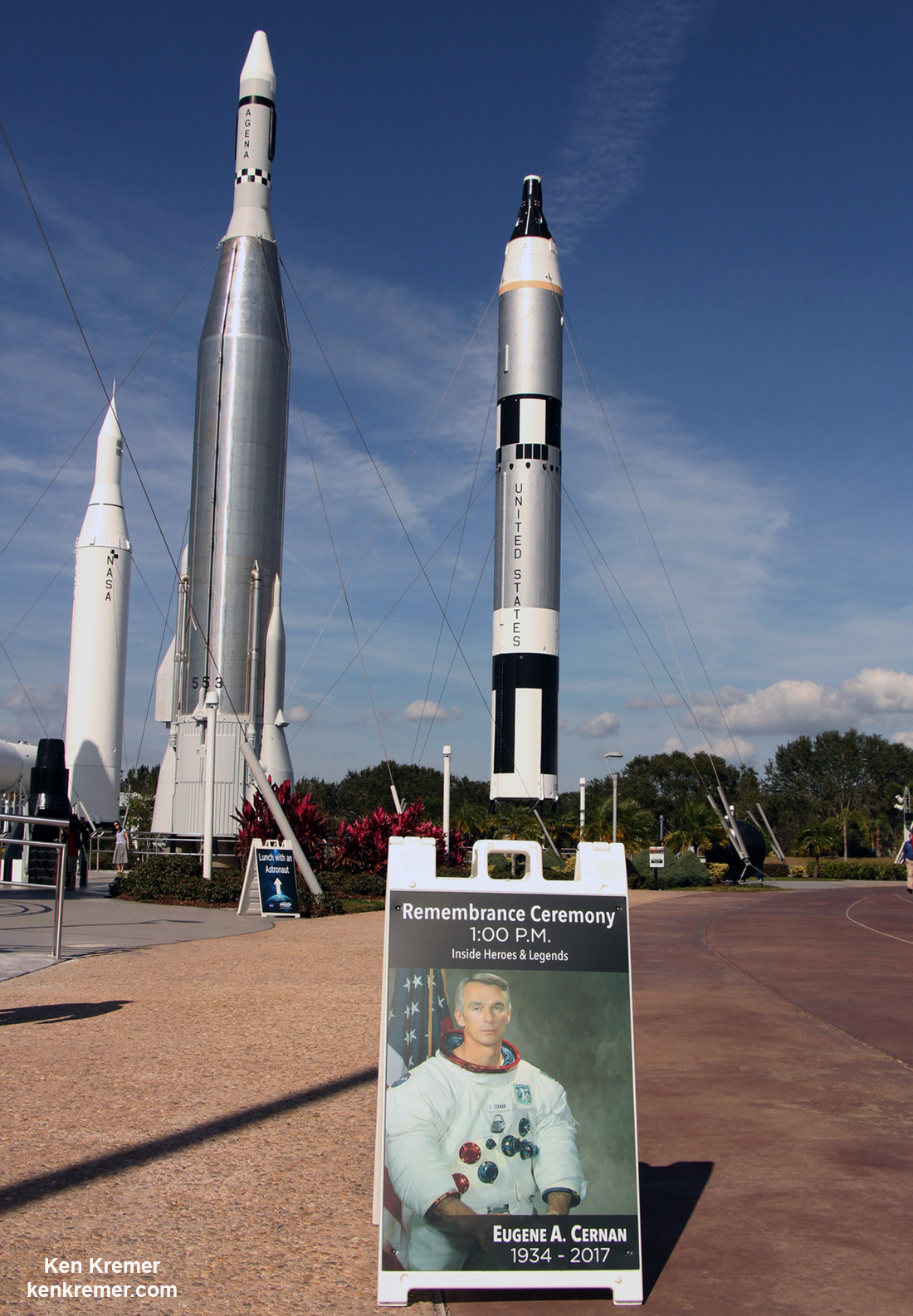
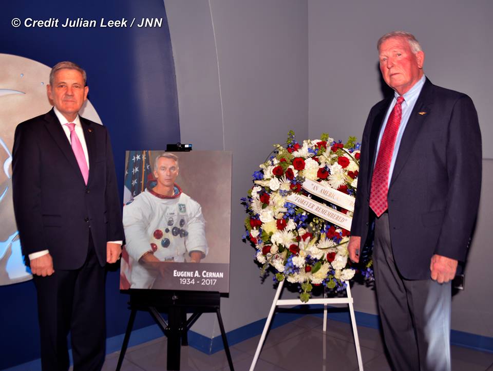
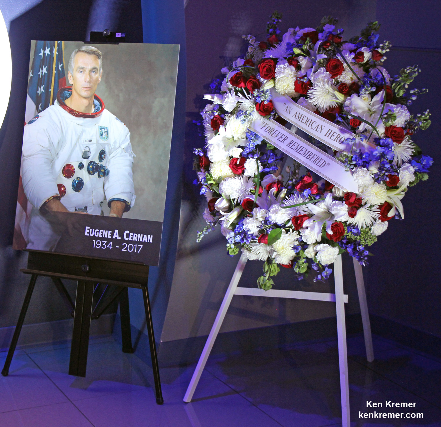
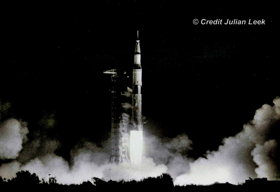
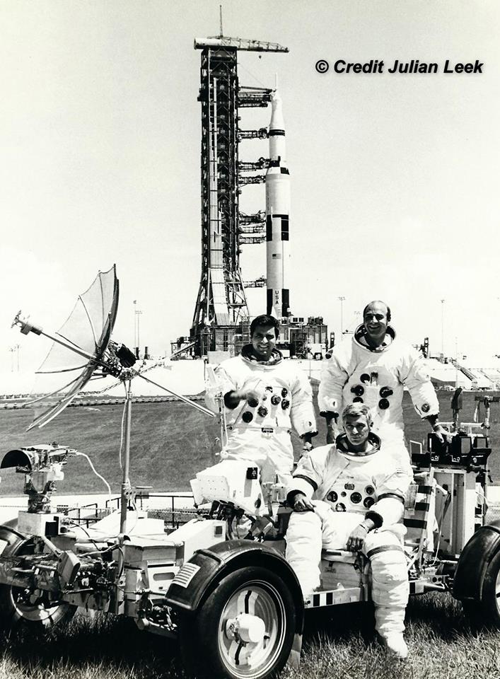
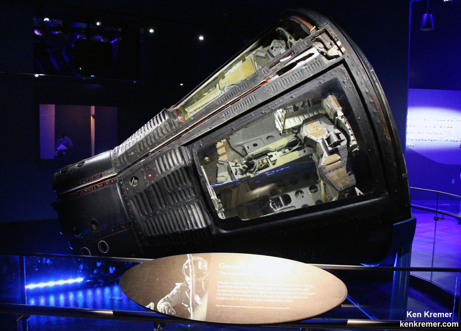
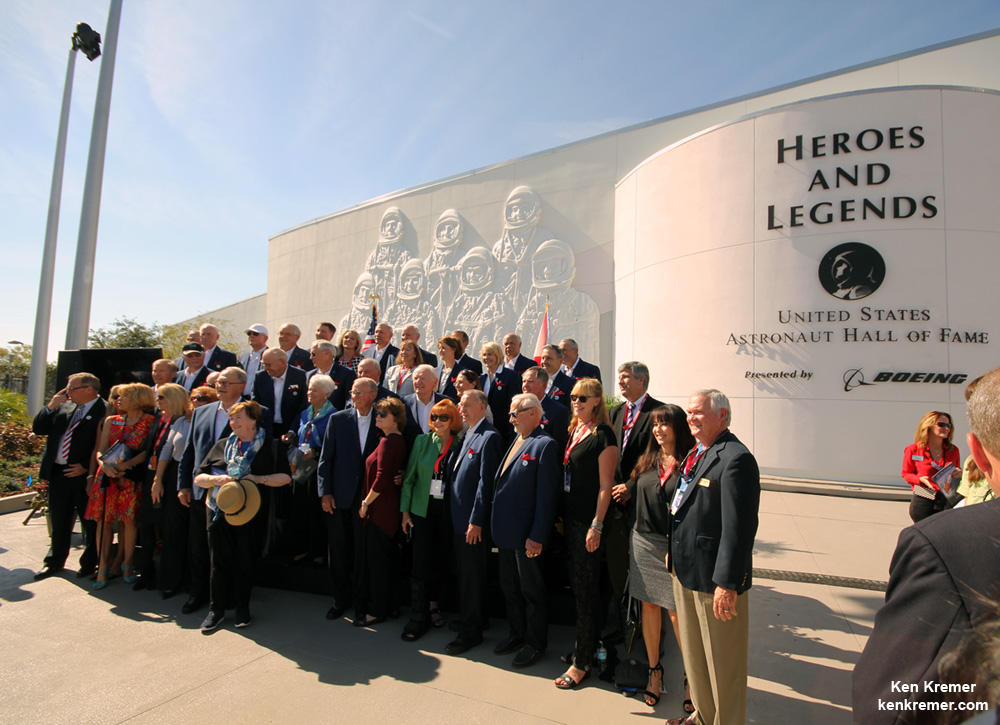
Gene Cernan, Last Man on the Moon, Honored at Kennedy Space Center Visitor Complex  Remembrance Ceremony honoring the life of astronaut Eugene Cernan, last Man to walk on the Moon during NASA's Apollo 17 moon landing mission in Dec. 1972, was held at the Kennedy Space Center Visitor Complex, Florida, on Jan. 18, 2017. Cernan passed away on Jan. 16, 2017. Credit: Ken Kremer/kenkremer.com KENNEDY SPACE CENTER VISITOR COMPLEX, FL – Gene Cernan, the last man to walk on the Moon, and one of America's most famous and renowned astronauts, was honored in a ceremony held at Kennedy Space Center Visitor Complex, Florida, on Jan. 18. [Story/photos expanded] Cernan passed away earlier this week on Monday, January 16, 2017 at age 82, after a long illness, surrounded by his family. Cernan, a naval aviator, flew on three groundbreaking missions for NASA during the Gemini and Apollo programs that paved the way for America's and humanity's first moon landing missions. His trio of historic space flights ultimately culminated with Cernan stepping foot on the moon in Dec. 1972 during the Apollo 17 mission- NASA final moon landing of the Apollo era. No human has set foot on the Moon since Apollo 17 – an enduring disappointment to Cernan and all space fans worldwide. Cernan also flew on the Gemini 9 and Apollo 10 missions, prior to Apollo 17. The Gemini 9 capsule is on display at the KSC Visitor Complex. Cernan was the second NASA astronaut to perform an EVA – during Gemini 9. The Cernan remembrance ceremony was held at the U.S. Astronaut Hall of Fame inside the newly opened 'Heroes & Legends' exhibit at the KSC Visitor Complex – two days after Cernan died. It included remarks from two of his fellow NASA astronauts from the Space Shuttle era, Kennedy Space Center Director Bob Cabana, and space shuttle astronaut Jon McBride, as well as Therrin Protze, chief operating officer, Kennedy Space Center Visitor Complex.  Robert Cabana, director of NASA's Kennedy Space Center and space shuttle astronaut Jon McBride, following remarks at the Jan 18, 2017 Remembrance Ceremony at the Kennedy Space Center Visitor Complex, Florida, honoring the life of astronaut Eugene Cernan. Credit: Julian Leek A NASA portrait and floral wreath were on display for visitors during the ceremony inside and outside of the 'Heroes and Legends' exhibit. "He was an advocate for the space program and hero that will be greatly missed," said Kennedy Space Center Director Bob Cabana during the ceremony inside. “I don’t believe that Gene is going to be the last man on the moon. And one of the things that he was extremely passionate about was our exploring beyond our own planet, and developing that capability that would allow us to go back to the moon and go beyond. “I feel badly that he wasn’t able to stay alive long enough to actually see this come to fruition,” Cabana said.  Portrait of NASA astronaut Gene Cernan and floral wreath displayed during the Jan. 18, 2017 Remembrance Ceremony at the Kennedy Space Center Visitor Complex, Florida, honoring his life as the last Man to walk on the Moon. Credit: Ken Kremer/kenkremer.com NASA is now developing the SLS heavy lift rocket and Orion deep space capsule to send our astronauts to the Moon, Mars and Beyond. The maiden launch of SLS-1 on the uncrewed EM-1 mission to the Moon is slated for Fall 2018. “We are saddened of the loss of our American hero, Astronaut Gene Cernan. As the last man to place footsteps on the surface of the moon, he was a truly inspiring icon who challenged the impossible," said Therrin Protze, chief operating officer of Kennedy Space Center Visitor Complex. "People throughout generations have been and will forever be inspired by his actions, and the underlying message that what we can achieve is limited only by our imaginations. He will forever be known as 'The Last Man on the Moon," and for the extraordinary impact he had on our country and the world.” Cernan was one of only 12 astronauts to walk on the moon. Neil Armstong and Buzz Aldrin were the first during the Apollo 11 moon landing mission in 1969 that fulfilled President Kohn F. Kennedy's promise to land on the Moon during the 1960's.  Launch of Apollo 17 – NASA's last lunar landing mission – on 7 December 1972 from Launch Complex-39A on the Kennedy Space Center, Florida. Credit: Julian Leek Cernan retired from NASA and the U.S. Navy in 1976. He continued to advise NASA as a consultant and appeared frequently on TV news programs during NASA's manned space missions as an popular guest explaining the details of space exploration and why we should explore. He advocated for NASA, space exploration and science his entire adult life.  The prime crew for the Apollo 17 lunar landing mission are: Commander, Eugene A. Cernan (seated), Command Module pilot Ronald E. Evans (standing on right), and Lunar Module pilot, Harrison H. Schmitt (left). They are photographed with a Lunar Roving Vehicle (LRV) trainer. Cernan and Schmitt used an LRV during their exploration of the Taurus-Littrow landing site. The Apollo 17 Saturn V Moon rocket is in the background. This picture was taken during October 1972 at Launch Complex 39A, Kennedy Space Center (KSC), Florida. Credit: Julian Leek "As an astronaut, Cernan left an indelible impression on the moon when he scratched his daughter’s initials in the lunar surface alongside the footprints he left as the last human to walk on the moon. Guests of Kennedy Space Center Visitor Complex can learn more about Cernan's legacy at the new Heroes & Legends exhibit, where his spacewalk outside the actual Gemini IX space capsule is brought to life through holographic imagery."  Actual Gemini 9 capsule piloted by Gene Cernan with Commander Thomas P. Stafford on a three-day flight in June 1966 on permanent display in the Heroes and Legends exhibit at the Kennedy Space Center Visitor Complex, Florida. Cernan logged more than two hours outside the orbiting capsule, as depicted in description. Credit: Ken Kremer/kenkremer.com From NASA's profile page: “Cernan was born in Chicago on March 14, 1934. He graduated from Proviso Township High School in Maywood, Ill., and received a bachelor of science degree in electrical engineering from Purdue University in 1956. He earned a master of science degree in aeronautical engineering from the U.S. Naval Postgraduate School in Monterey, Calif. Cernan is survived by his wife, Jan Nanna Cernan, his daughter and son-in-law, Tracy Cernan Woolie and Marion Woolie, step-daughters Kelly Nanna Taff and husband, Michael, and Danielle Nanna Ellis and nine grandchildren.” The following is a statement released by NASA on the behalf of Gene Cernan's family: A funeral service for Capt. Eugene A. Cernan, who passed away Monday at the age of 82, will be conducted at 2:30 p.m. CST on Tuesday, Jan. 24, at St. Martin's Episcopal Church, 717 Sage Road in Houston. NASA Television will provide pool video coverage of the service. The family will gather for a private interment at the Texas State Cemetery in Austin at a later date, where full military honors will be rendered. Stay tuned here for Ken’s continuing Earth and Planetary science and human spaceflight news. Ken Kremer  Grand opening ceremony for the 'Heroes and Legends' attraction on Nov. 11, 2016 at the Kennedy Space Center Visitor Complex in Florida and attended by more than 25 veteran and current NASA astronauts. Credit: Ken Kremer/kenkremer.com The post Gene Cernan, Last Man on the Moon, Honored at Kennedy Space Center Visitor Complex appeared first on Universe Today.
Weekly Space Hangout – January 20, 2017: Dan Dixon – Project Lead & Creator of Universe Sandbox Host: Fraser Cain (@fcain) Special Guest:
Dan Dixon is the creator and director of Universe Sandbox ², an accessible space simulator application that merges real-time gravity, climate, collision, and physical interactions to reveal the beauty of our universe and the fragility of our planet. Dan began work on the original Universe Sandbox in 2006, and continues to work on the latest version, Universe Sandbox ², with the help of a growing team of talented developers, artists, and scientists. Website: UniverseSandbox.com
Twitter: @UniverseSandbox
Facebook: Universe Sandbox Guests:
Morgan Rehnberg (MorganRehnberg.com / @MorganRehnberg)
Kimberly Cartier ( KimberlyCartier.org / @AstroKimCartier ) Their stories this week:
NASA looks to buy Soyuz seats from Russia Two new NASA missions Coating Ceres in interplanetary dust Public to choose JunoCam sites Using geometry to explain pulsar puzzle We use a tool called Trello to submit and vote on stories we would like to see covered each week, and then Fraser will be selecting the stories from there. Here is the link to the Trello WSH page (http://bit.ly/WSHVote), which you can see without logging in. If you’d like to vote, just create a login and help us decide what to cover! If you would like to join the Weekly Space Hangout Crew, visit their site here and sign up. They’re a great team who can help you join our online discussions! If you would like to sign up for the AstronomyCast Solar Eclipse Escape, where you can meet Fraser and Pamela, plus WSH Crew and other fans, visit our site linked above and sign up! We record the Weekly Space Hangout every Friday at 12:00 pm Pacific / 3:00 pm Eastern. You can watch us live on Universe Today, or the Universe Today YouTube page The post Weekly Space Hangout – January 20, 2017: Dan Dixon – Project Lead & Creator of Universe Sandbox appeared first on Universe Today.
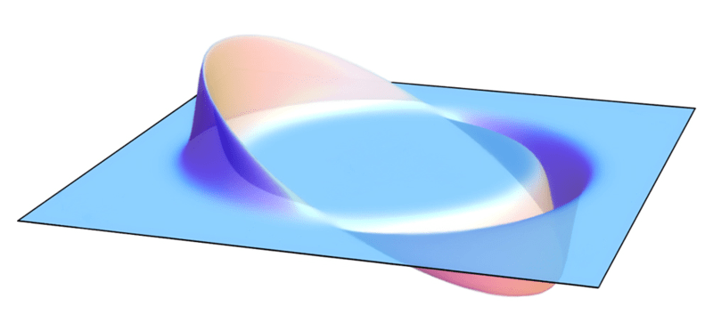
What is the Alcubierre "Warp" Drive? It's always a welcome thing to learn that ideas that are commonplace in science fiction have a basis in science fact. Cryogenic freezers, laser guns, robots, silicate implants… and let's not forget the warp drive! Believe it or not, this concept – alternately known as FTL (Faster-Than-Light) travel, Hyperspace, Lightspeed, etc. – actually has one foot in the world of real science. In physics, it is what is known as the Alcubierre Warp Drive. On paper, it is a highly speculative, but possibly valid, solution of the Einstein field equations, specifically how space, time and energy interact. In this particular mathematical model of spacetime, there are features that are apparently reminiscent of the fictional “warp drive” or "hyperspace" from notable science fiction franchises, hence the association. Background: Since Einstein first proposed the Special Theory of Relativity in 1905, scientists have been operating under the restrictions imposed by a relativistic universe. One of these restrictions is the belief that the speed of light is unbreakable and hence, that there will never be such a thing as FTL space travel or exploration.  Visualization of a warp field, according to the Alcubierre Drive. Credit: AllenMcC Even though subsequent generations of scientists and engineers managed to break the sound barrier and defeat the pull of the Earth's gravity, the speed of light appeared to be one barrier that was destined to hold. But then, in 1994, a Mexican physicist by the name of Miguel Alcubierre came along with proposed method for stretching the fabric of space-time in way which would, in theory, allow FTL travel to take pace. Concept: To put it simply, this method of space travel involves stretching the fabric of space-time in a wave which would (in theory) cause the space ahead of an object to contract while the space behind it would expand. An object inside this wave (i.e. a spaceship) would then be able to ride this region, known as a “warp bubble” of flat space. This is what is known as the “Alcubierre Metric”. Interpreted in the context of General Relativity, the metric allows a warp bubble to appear in a previously flat region of spacetime and move away, effectively at speeds that exceed the speed of light. The interior of the bubble is the inertial reference frame for any object inhabiting it. Since the ship is not moving within this bubble, but is being carried along as the region itself moves, conventional relativistic effects such as time dilation would not apply. Hence, the rules of space-time and the laws of relativity would not be violated in the conventional sense.  Artist’s concept of a spacecraft using an Alcubierre Warp Drive. Credit: NASA One of the reasons for this is because this method would not rely on moving faster than light in the local sense, since a light beam within this bubble would still always move faster than the ship. It is only “faster than light” in the sense that the ship could reach its destination faster than a beam of light that was traveling outside the warp bubble. Difficulties: However, there is are few problems with this theory. For one, there are no known methods to create such a warp bubble in a region of space that would not already contain one. Second, assuming there was a way to create such a bubble, there is not yet any known way of leaving once inside it. As a result, the Alcubierre drive (or metric) remains in the category of theory at this time. Mathematically, it can be represented by the following equation: ds2= – (a2 – BiBi) dt2 + 2Bi dxi dt + gijdxi dxj, where a is the lapse function that gives the interval of proper time between nearby hypersurfaces, Bi is the shift vector that relates the spatial coordinate systems on different hypersurfaces and gij is a positive definite metric on each of the hypersurfaces. Attempts at Development: In 1996, NASA founded a research project known as the Breakthrough Propulsion Physics Project (BPP) to study various spacecraft proposals and technologies. In 2002, the project’s funding was discontinued, which prompted the founder – Marc G. Millis – and several members to create the Tau Zero Foundation. Named after the famous novel of the same name by Poul Anderson, this organization is dedicated to researching interstellar travel. In 2012, NASA’s Advanced Propulsion Physics Laboratory (aka. Eagleworks) announced that they had began conducting experiments to see if a “warp drive” was in fact possible. This included developing an interferometer to detect the spatial distortions produced by the expanding and contracting space-time of the Alcubierre metric. The team lead – Dr. Harold Sonny White – described their work in a NASA paper titled Warp Field Mechanics 101. He also explained their work in NASA’s 2012 Roundup publication: “We've initiated an interferometer test bed in this lab, where we're going to go through and try and generate a microscopic instance of a little warp bubble. And although this is just a microscopic instance of the phenomena, we're perturbing space time, one part in 10 million, a very tiny amount… The math would allow you to go to Alpha Centauri in two weeks as measured by clocks here on Earth. So somebody's clock onboard the spacecraft has the same rate of time as somebody in mission control here in Houston might have. There are no tidal forces, no undue issues, and the proper acceleration is zero. When you turn the field on, everybody doesn't go slamming against the bulkhead, (which) would be a very short and sad trip." In 2013, Dr. White and members of Eagleworks published the results of their 19.6-second warp field test under vacuum conditions. These results, which were deemed to be inconclusive, were presented at the 2013 Icarus Interstellar Starship Congress held in Dallas, Texas. When it comes to the future of space exploration, some very tough questions seem unavoidable. And questions like “how long will it take us to get the nearest star?” seem rather troubling when we don’t make allowances for some kind of hypervelocity or faster-than-light transit method. How can we expect to become an interstellar species when all available methods with either take centuries (or longer), or will involve sending a nanocraft instead? At present, such a thing just doesn’t seem to be entirely within the realm of possibility. And attempts to prove otherwise remain unsuccessful or inconclusive. But as history has taught us, what is considered to be impossible changes over time. Someday, who knows what we might be able to accomplish? But until then, we’ll just have to be patient and wait on future research. We have written many articles about the Alcubierre "Warp" Drive for Universe Today. Here’s Warp Drives Probably Impossible After All, Warp Drives and Cloaking Devices not just Science Fiction Anymore, Warp Drive May Come with a Killer Downside, Astronomy Without a Telescope – Warp Drive on Paper, and Zoom, Zoom, Zoom: Gorgeous Warp Ship Design Delights The Internet. If you’d like more info on the Alcubierre "Warp" Drive, check out an article from Wikipedia. Also, check out another article about the warp drive spaceship engine. We’ve also recorded an entire episode of Astronomy Cast all about Light Echoes. Listen here, Episode 215: Light Echoes. Sources: The post What is the Alcubierre “Warp” Drive? appeared first on Universe Today.
Bullseye: Amazing SpaceX Images Highlight Perfect Falcon 9 Landing SpaceX was able to celebrate a successful return to flight this week with a picture-perfect launch of the Falcon 9 rocket on January 14, 2017 that successfully delivered a fleet of ten advanced Iridium NEXT mobile voice and data relay satellites to orbit. But the icing on the cake was the dead-center landing and recovery of the Falcon 9 booster on their drone barge (named “Just Read The Instructions”) in the Pacific Ocean, off the west coast of California. SpaceX released some images from the landing that are absolutely stunning, like this one, below:  A stunning view of the Falcon 9 rocket just before landing on a barge in the Pacific Ocean, on January 14, 2017 following the launch of 10 Iridium NEXT satellites into orbit. Credit: SpaceX. The Falcon 9 launched from Space Launch Complex 4E on Vandenberg Air Force Base in California, and the main goal of the mission was to deploy the payload of the first ten Iridium Next communication satellites to low Earth orbit. Iridium plans to eventually have a fleet of 81 such satellites. It was the first launch for the commercial company since the September 1, 2016 explosion on the launchpad at Cape Canaveral Air Force Station in Florida during a routine launchpad test. The explosion destroyed the Falcon 9 rocket and the payload of the Amos-6 communications satellite, which had an estimated value of $200 million. The explosion was traced back to a failure of a high-pressure helium vessel inside the Falcon 9’s second-stage liquid-oxygen tank. Enjoy more images and video from the landing below:  Another view of the SpaceX Falcon 9 booster after landing on a barge in the Pacific Ocean on January 14, 2017. Credit: SpaceX.  The Falcon 9 booster sitting successfully on the barge after landing. Credit: SpaceX. Here’s the full webcast of both the launch and landing: You can see all of SpaceX’s latest images on their Flickr stream. The post Bullseye: Amazing SpaceX Images Highlight Perfect Falcon 9 Landing appeared first on Universe Today.
|
| Email subscriptions powered by FeedBlitz, LLC, 365 Boston Post Rd, Suite 123, Sudbury, MA 01776, USA. |
| |
























No comments:
Post a Comment
Keep a civil tongue.